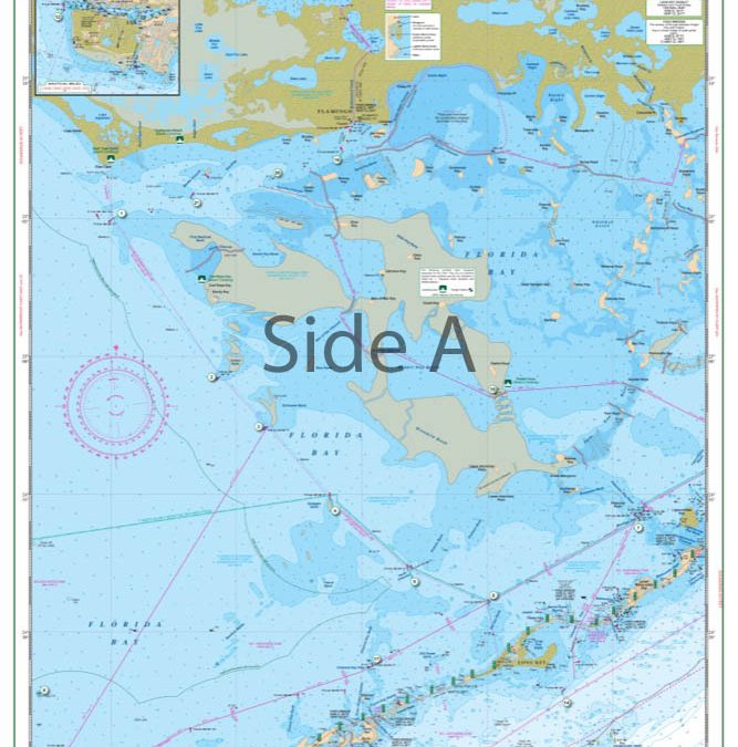
by dev22p1 | Mar 23, 2017
The most detailed and complete coverage of the Everglades National Park area from Key Largo to Flamingo and South to Marathon. This excellent guide to the “Backcountry” details marked cuts and channels, areas of recently reported shoaling, areas open to...
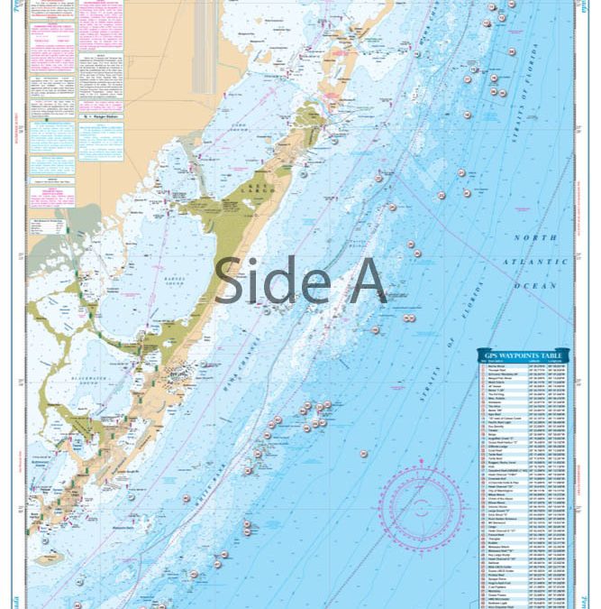
by dev22p1 | Mar 23, 2017
Completely redone in 2014 with coverage from Turkey Point in Biscayne Bay south to Lower Matecumbe Key. Detailed coverage of both Atlantic and Florida Bay sides of the Keys. Complete coverage of Card Sound, Barnes Sound and Blackwater Sound and Pennekamp Coral Reef...
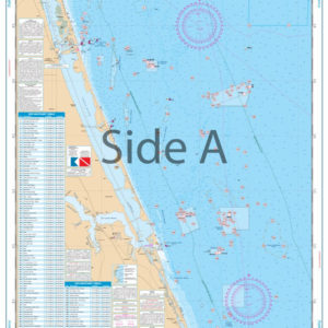 Palm Beach to Fort Pierce Offshore Fish and Dive Chart 127F
$32.95
Palm Beach to Fort Pierce Offshore Fish and Dive Chart 127F
$32.95
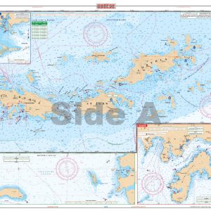 U.S. Virgin Islands - Large Print Navigation Chart 132E
$34.95
U.S. Virgin Islands - Large Print Navigation Chart 132E
$34.95
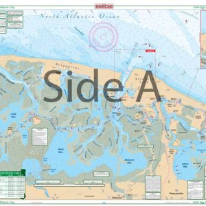 Little Egg Harbor To Atlantic City Large Print Navigation Chart 156E
$32.95
Little Egg Harbor To Atlantic City Large Print Navigation Chart 156E
$32.95
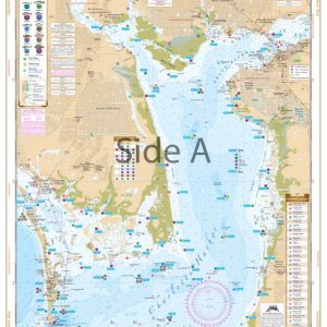 Charlotte Harbor and Lemon Bay Inshore Fishing Chart 1F
$32.95
Charlotte Harbor and Lemon Bay Inshore Fishing Chart 1F
$32.95
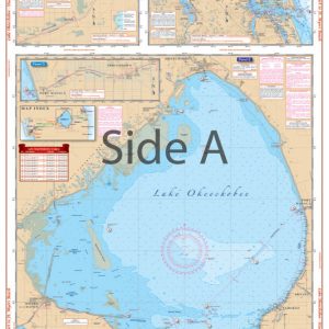 Lake Okeechobee Stuart to Fort Myers Beach Crossing Navigation Chart 20
$32.95
Lake Okeechobee Stuart to Fort Myers Beach Crossing Navigation Chart 20
$32.95