Boothbay Harbor Large Print Navigation Chart 102E
The Area Covered
$32.95
Don’t leave the dock without this Boothbay Harbor navigation map. We mean it! If you are in the Boothbay Harbor area, you’ll love this highly detailed, brightly colored nautical map. You’ll enjoy it so much you will want it framed and hung on your wall.
The Area Covered
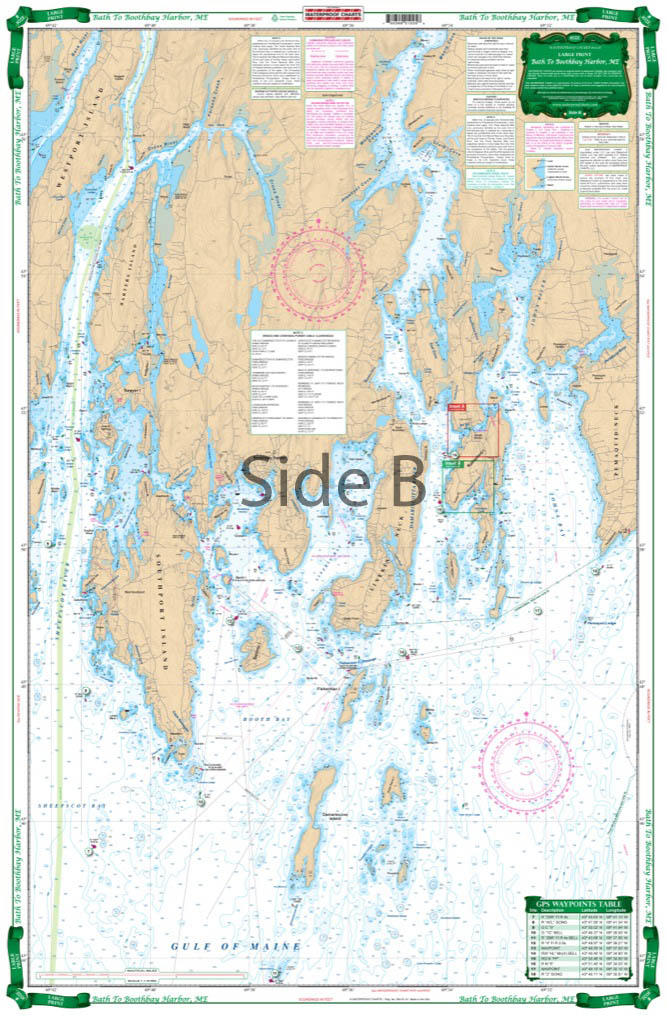
Large Print - Side A provides detailed coverage from Cape Small and Small Point Harbor to Sheepscot Bay and the Sheepscot River.This side shows wonderful detail of the Kennebec River to Bath and the Sheepscot River north to Westport. Side A has 9 pre-plotted GPS Waypoints for Navigation Aids along the coast. Side B of Chart #102E begins at the Sheepscot River and continues east to Pemaquid point. This Side shows excellent detail of Boothbay Harbor, Damariscove Island, The Cockholds, and the Damariscotta River. Side B of the great chart has 2 excellent detailed insets of Christmas Cove and "The Gut", showing South Bristol Harbor. This side of the Chart has 11 pre-plotted GPS Waypoints. Information from NOAA Chart #13290. Don't leave the dock without this Boothbay Harbor navigation map. We mean it! If you are in the Boothbay Harbor area, you'll love this highly detailed, brightly colored nautical map. You'll enjoy it so much you will want it framed and hung on your wall. Side A provides detailed coverage from Cape Small and Small Point Harbor to Sheepscot Bay and the Sheepscot River. This side also shows amazing detail of the Kennebec River to Bath and the Sheepscot River north to Westport. Side A also contains 9 GPS Waypoints to help you navigate the coastline. Now, Side B contains the area beginning at Sheepscot River continuing east to Pemaquid point. This side of the nautical chart also contains a clear view of Boothbay Harbor, Damariscove Island, the Cockholds, and the Damariscota River. Side B of this information-packed nautical map also has 2 detailed insets of Christmas Cove and "The Gut", showing South Bristol Harbor. This side of the nautical chart also has 11 GPS waypoints for added benefit. Information from NOAA Charts #13290. Chart is 25" X 38". WGS84 - World Mercator Datum
Additional information
| Weight | 0.2 oz |
|---|---|
| Dimensions | 24 × 36 in |