Cape Cod, New York and Vermont

Cape Cod, New York and Vermont
Explore Waterproof Charts selection of navigation charts for Cape Cod, New York and Vermont. These charts are ideal for offshore fishing, diving and navigation.
Areas of Coverage
- #10 Martha’s Vineyard and Nantucket Navigation Chart
- #164F Bluefin, Georges, Canyons Maxi Offshore Fishing Chart
- #65 Massachusetts Bay, Boston Harbor, and Marblehead Navigation Chart
- #62F Raritan Bay and Jamaica Bay Coastal Fishing Chart
- #65F Cape Cod Bay and Massachusetts Bay Coastal Fishing Chart
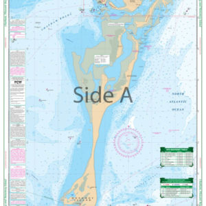
- #64 Cape Cod and Harbors Navigation Chart
- #64F Massachusetts Coastal Fishing Chart
- #60 Fishers Island Sound Navigation Chart
- #61F Buzzards Bay and Nantucket Sound Coastal Fishing Chart
- #62 New York Harbor (Manhattan) Navigation Chart
- #57 Hudson River Navigation Chart
- #50E Chatham, Pleasant Bay, and Monomoy Island Large Print Navigation Chart
- #50F Narragansett Bay to Block Island Sound Coastal Fishing Chart
- #2E New York Harbor to Block Island Large Print Navigation Chart
- #140 Clayton and Alexandria Bay Navigation Chart
- #141 Northeast Lake Ontario Kingston and Bateau Channel Navigation Chart
- #12F Lake Champlain North Lake Fishing Chart
- #11F Lake Champlain South Lake Fishing Chart
- #12 Northern Lake Champlain Navigation Chart
- #50 Block Island to Chatham Navigation Chart
- #11 Champlain Canal and South Lake Champlain Navigation Chart
- #6E Great South Bay Large Print Navigation Chart
- #61 Narragansett and Buzzards Bay Navigation Chart
- #67 Peconic and Gardiners Bays Navigation Chart
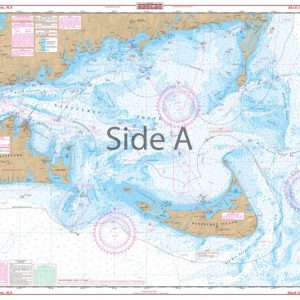
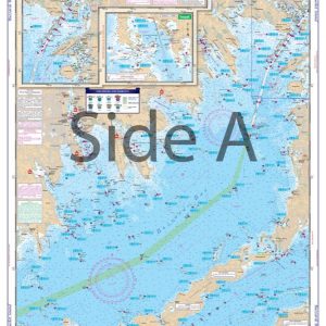
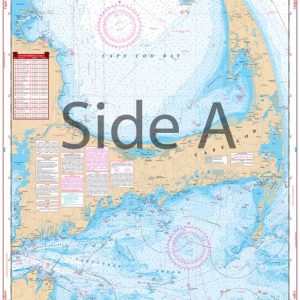
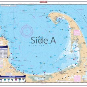
Chart Details
Furthermore, our charts are printed on durable, waterproof, and tear-resistant 25″ x 38″ paper. Each chart is packed with valuable features, including depths, currents, coastal features, pre-plotted GPS coordinates (WGS84 – World Mercator Datum) and marked locations for waterfront dining, boat ramps, and fueling stations.
Additional Coverage
We cover areas from Maine to Texas, Bahamas, Caribbean Islands, Great Lakes, and the West Coast of the United States from Washington to Mexico. Whether navigating coastal waters, lakes, or oceans, you will find our charts reliable and accurate.
Showing 1–9 of 24 results
-
Block Island to Chatham Navigation Chart 50
$32.95 -

Bluefin, Georges, Canyons Maxi Offshore Fishing Chart 164F
$32.95 -
Buzzards Bay and Nantucket Sound Coastal Fishing Chart 61F
$32.95 -
Cape Cod and Harbors Navigation Chart 64
$32.95 -
Cape Cod Bay and Massachusetts Bay Coastal Fishing Chart 65F
$32.95 -

Champlain Canal and South Lake Champlain Navigation chart 11
$32.95 -
Chatham, Pleasant Bay, and Monomoy Island Large Print Navigation Chart 50E
$32.95 -
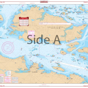
Clayton and Alexandria Bay Navigation Chart 140
$32.95 -
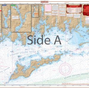
Fishers Island Sound Navigation Chart 60
$32.95