Pacific Northwest
The Pacific Northwest
Explore Waterproof Charts selection of navigation charts for the Pacific Northwest. These charts are ideal for offshore fishing, diving and navigation.
Areas of Coverage
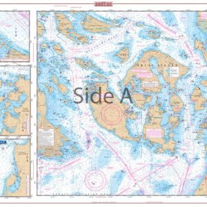
- #30 Puget Sound Navigation Chart
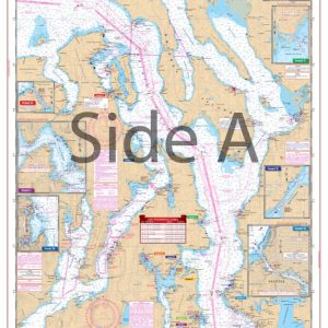
- #43 San Juan Islands Navigation Chart
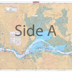
- #79 San Joaquin River and Delta Navigation Chart
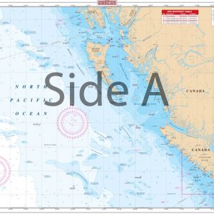
- #83 Pacific Northwest Maxi Navigation Chart
Chart Details
Furthermore, our charts are printed on durable, waterproof, and tear-resistant 25″ x 38″ paper. Each chart is packed with valuable features, including depths, currents, coastal features, pre-plotted GPS coordinates (WGS84 – World Mercator Datum) and marked locations for waterfront dining, boat ramps, and fueling stations.
Additional Coverage
We cover areas from Maine to Texas, Bahamas, Caribbean Islands, Great Lakes, and the West Coast of the United States from Washington to Mexico. Whether navigating coastal waters, lakes, or oceans, you will find our charts reliable and accurate.
Showing all 4 results