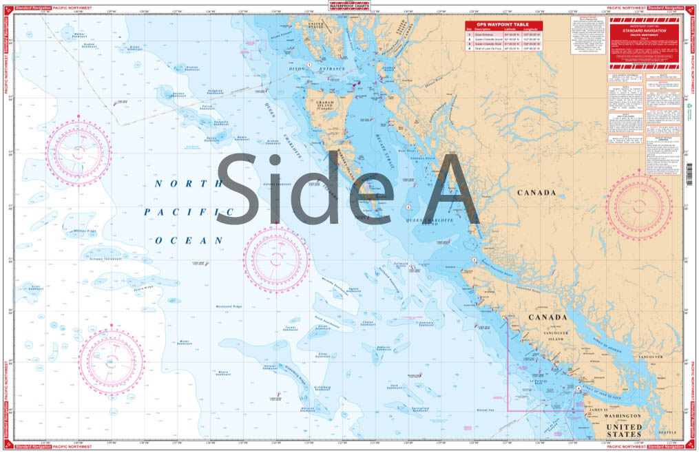
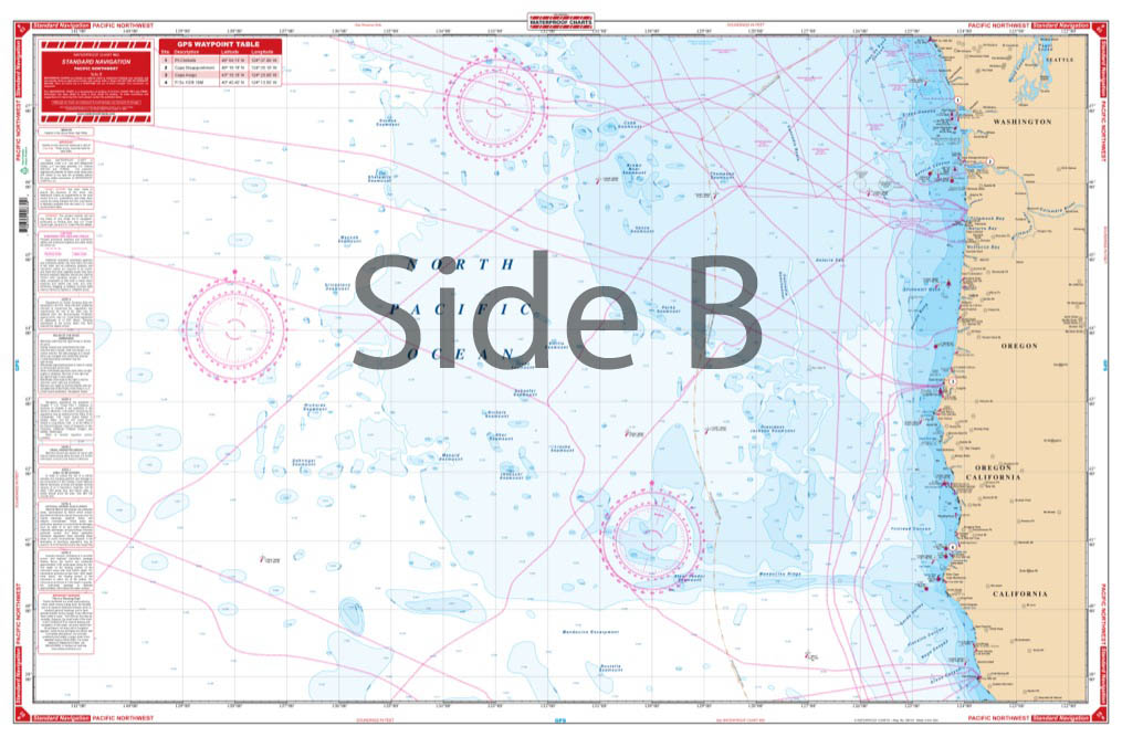
Pacific Northwest Maxi Navigation Chart 83
The Area Covered
$32.95
Coverage from Prince of Wales Island Alaska and the Dixon Entrance South to Ft Bragg California. GPS waypoint table for the major entrances are listed. This is a must-have marine map if you plan to boat the waters of the Pacific Northwest. There is excellent offshore coverage in this north Atlantic Ocean map.
The Area Covered
Coverage from Prince of Wales Island Alaska and the Dixon Entrance South to Ft Bragg California. GPS waypoint table for the major entrances are listed. This is a must-have marine map if you plan to boat the waters of the Pacific Northwest. There is excellent offshore coverage in this north Atlantic Ocean map. This navigation map has coverage from Prince of Wales Island Alaska and the Dixon Entrance South to Ft Bragg California. A GPS waypoint table for the major entrances are listed. The bright colors of this marine map make it a great gift or wall display when framed. Information from 3 NOAA Charts #501, #531, #18007. Nautical chart #85 continues south to Cabo San Lucas. Navigation Chart is 25" X 38". WGS84 - World Mercator Datum.
Additional information
| Dimensions | 24 × 36 in |
|---|