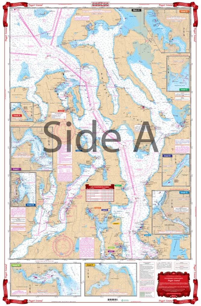
Puget Sound Navigation Chart 30
The Area Covered
$32.95
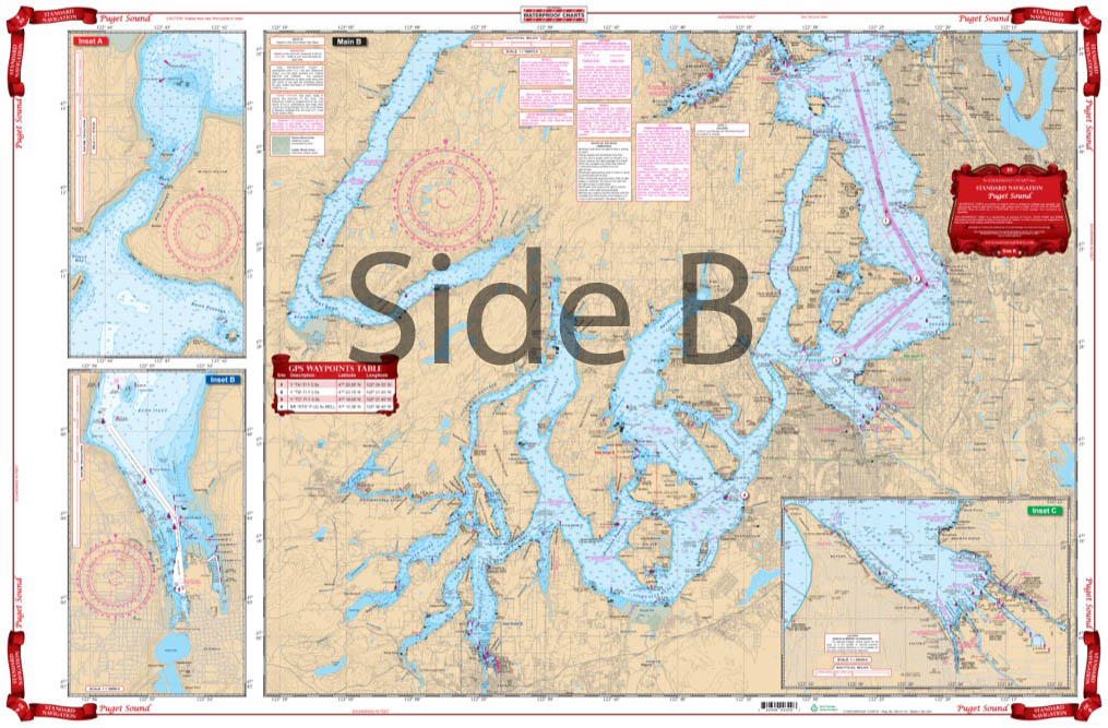
Complete Coverage from Olympia through Seattle to Port Townsend and Skagit Bay. Excellent Details for Tacoma, Olympia, Pitt Passage and Gig Harbor on south side. Blow Ups for Port Madison, Eagle Harbor, Agate Passage, Seattle, Kingston, Port Ludlow, Rich Passage, Port Townsend Canal and Liberty Bay on the north side. GPS Waypoints are printed directly on the chart. Color Keyed Insets are easy to find. This Puget Sound nautical chart is as comprehensive as they come.
The Area Covered
Complete Coverage from Olympia through Seattle to Port Townsend and Skagit Bay. Excellent Details for Tacoma, Olympia, Pitt Passage and Gig Harbor on south side. Blow Ups for Port Madison, Eagle Harbor, Agate Passage, Seattle, Kingston, Port Ludlow, Rich Passage, Port Townsend Canal and Liberty Bay on the north side. GPS Waypoints are printed directly on the chart. Color Keyed Insets are easy to find. This Puget Sound nautical chart is as comprehensive as they come. Don't let the vibrant colors and illustration sit hidden on your boat. Get this navigation chart framed and display it proudly on your wall. Find complete coverage from Olympia through Seattle to Port Townsend and Skagit Bay. Excellent details for Tacoma, Olympia, Pitt Passage and Gig Harbor on south side. Blow ups are included for Port Madison, Eagle Harbor, Agate Passage, Seattle, Kingston, Port Ludlow, Rich Passage, Port Townsend Canal and Liberty Bay on the north side. GPS waypoints are printed directly on the navigation map. Color keyed insets are easy to find and use no matter if you're on a kayak, paddleboard, boat. Information from 6 Different NOAA Charts; #18445, #18448, #18449, #18446, #18464 & #18441. Nautical chart is 25" X 38". WGS84 - World Mercator Datum.
Additional information
| Weight | 0.2 oz |
|---|---|
| Dimensions | 24 × 36 in |