Mobile Bay to Pensacola Offshore Fish and Dive Chart 94F
The Area Covered
$32.95
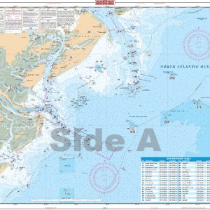
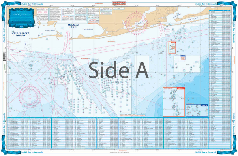
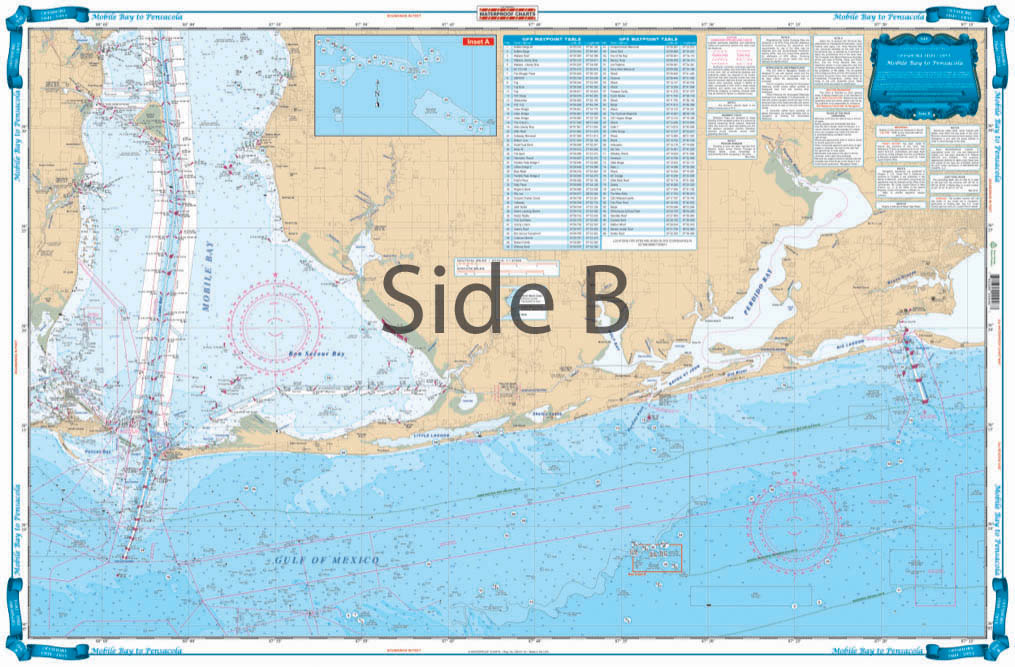
Offshore coverage from Dauphin Island, Alabama to Pensacola Beach Florida out 30 plus miles. This chart is a compilation of 3 NOAA charts: #11360, #11376 and #11382. This chart goes up into MOBILE BAY over 21 miles, and offshore over 30 miles. From Daupin Island the chart goes over 55 miles to the South. The chart has over 550 plotted GPS waypoints for wrecks, reefballs, ledges and artificial reefs, fishing and diving locations. The really unique feature to this Offshore Fishing Chart is that it is LARGE PRINT!!!
The Area Covered
Offshore coverage from Dauphin Island, Alabama to Pensacola Beach Florida out 30 plus miles. This chart is a compilation of 3 NOAA charts: #11360, #11376 and #11382. This chart goes up into MOBILE BAY over 21 miles, and offshore over 30 miles. From Daupin Island the chart goes over 55 miles to the South. The chart has over 550 plotted GPS waypoints for wrecks, reefballs, ledges and artificial reefs, fishing and diving locations. The really unique feature to this Offshore Fishing Chart is that it is LARGE PRINT!!! Meaning it is much easier to see the coordinates of your favorite fishing destination. No one has a chart like this. If you want to enjoy all of the State, County and private fishing locations in this area, you MUST have this Waterproof Charts Offshore Fishing Chart #94F. If you want ORANGE BEACH , Alabama, you want this chart. Gulf Coast fishing doesn't get better than this! Our fishing charts come packed with local information provided by charter boat captains. You are sure to find fish in at least one of these spots. Offshore coverage on this fishing chart runs from Dauphin Island Alabama to Pensacola Beach Florida out 30 plus miles. This navigation chart is a compilation of 3 NOAA charts: #11360, #11376 and #11382. This marine map goes up into Mobile Bay over 21 miles, and offshore over 30 miles. From Dauphin Island the chart goes over 55 miles to the South. The chart has over 550 plotted GPS waypoints for wrecks, reefballs, ledges and artificial reefs, fishing and diving locations. The really unique feature to this Offshore Fishing Chart is the large, easy to read print. Meaning it is much easier to see the coordinates of your favorite fishing destination. No one has a nautical map like this. If you want to enjoy all of the state, county and private fishing locations in this area, you MUST have this Waterproof Charts Offshore Fishing Chart #94F. Nautical Chart is 25" X 38". WGS84 - World Mercator Datum.
Additional information
| Dimensions | 24 × 36 in |
|---|