Straits of Florida Offshore Fish and Dive Chart 10F
The Area Covered
$32.95
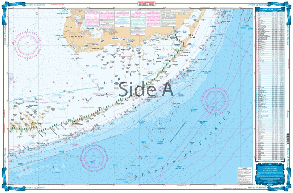
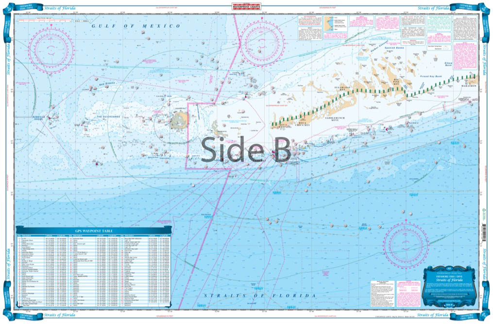
What Floridian doesn’t own a boat, kayak, paddleboard, jet ski? Not many! For those of you that would rather be on the water than onshore, you need our Florida charts. This nautical map provides offshore coverage from Rebecca Shoal (west of Key West) to North of Key Largo.
The Area Covered
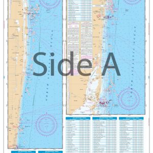
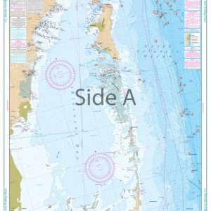
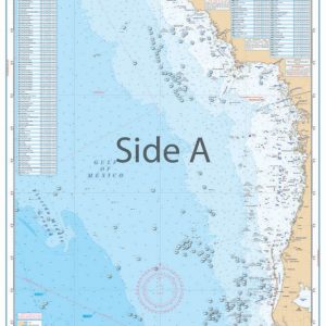
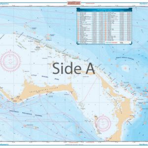
Offshore coverage from Rebecca Shoal (west of Key West) to North of Key Largo. Shows depths from the reef out to 500 fathoms and sections of the Gulf to north of Cape Sable. Does not show detail inside the reef or in east Florida Bay nor close to the Keys. Bathymetric contours have been added in popular fishing areas and peaks and holes have been highlighted. A total of 200 Plotted and Indexed GPS Positions for reefs and wrecks, fishing areas such as the "Hump", "Woods Wall", and the "Ups and Downs". What Floridian doesn't own a boat, kayak, paddleboard, jet ski? Not many! For those of you that would rather be on the water than onshore, you need our Florida charts. This nautical map provides offshore coverage from Rebecca Shoal (west of Key West) to North of Key Largo. These fishing charts show depths from the reef out to 500 fathoms and sections of the Gulf to north of Cape Sable. Bathymetric contours have been added in popular fishing areas and peaks and holes have been highlighted (to help you catch more fish!). A total of 200 Plotted and Indexed GPS Positions for reefs and wrecks, fishing areas such as the "Hump", "Woods Wall", and the "Ups and Downs", are displayed on these marine maps for your convenience. The vibrant colors and designs make this navigation chart excellent for framing. (Please be aware that this nautical chart does not show detail inside the reef or in east Florida Bay nor close to the Keys.) Information from 2 NOAA Charts: 11434 and 11450. Nautical Chart is 25" X 38". WGS84 - World Mercator Datum.
Additional information
| Weight | 0.2 oz |
|---|---|
| Dimensions | 24 × 36 in |