Cape Canaveral Offshore Fish and Dive Chart 124F
The Area Covered
$32.95
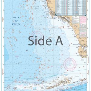
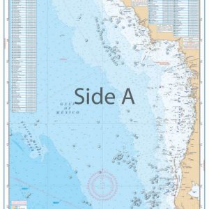
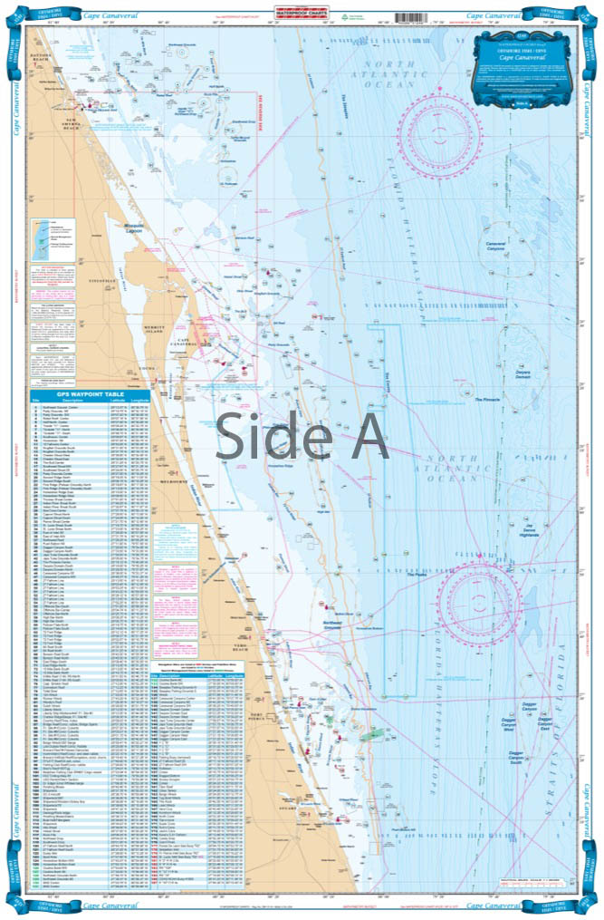
Don’t head offshore without this Offshore Cape Canaveral fishing chart. This navigation map has coverage from Ponce Inlet south to Stuart and out to 60 miles offshore. This nautical chart is derived from 4 different Baythymetric charts showing detailed bottom contour thru the deepest water.
The Area Covered
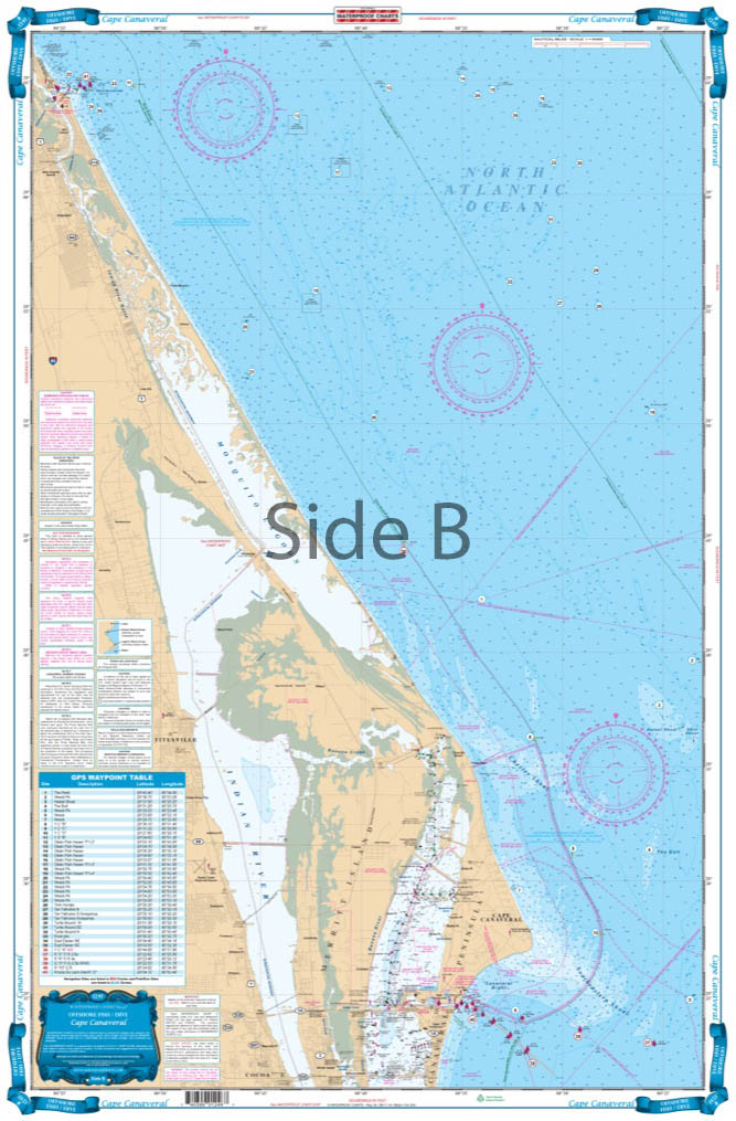
Coverage from Ponce Inlet south to Stuart and out to 60 miles offshore. Derived from 4 different Baythymetric charts showing detailed bottom contour thru the deepest water. Popular fishing grounds are highlighted with their local names and GPS coordinates. Over 160 indexed and plotted coordinates for fishing on the offshore side. The reverse side is more detailed coastal coverage from Ponce Inlet to south of the Port Canaveral channel with additional coordinates for buoys and fishing areas. A total of over 200 coordinates. Don't head offshore without this Offshore Cape Canaveral fishing chart. This navigation map has coverage from Ponce Inlet south to Stuart and out to 60 miles offshore. This nautical chart is derived from 4 different Baythymetric charts showing detailed bottom contour thru the deepest water. Popular fishing grounds are highlighted with their local names and GPS coordinates (to help you catch more fish!). You will find over 160 indexed and plotted coordinates for fishing on the offshore side. The reverse side has more detailed coastal coverage from Ponce Inlet to south of the Port Canaveral channel with additional coordinates for buoys and fishing areas. A total of over 200 coordinates! You can easily add these useful coordinates into your GPS unit. These marine maps is perfect for framing on the wall of your home or office. Information from NOAA charts #11484 and 4 Bathymetric charts. Nautical Chart is 25" X 38". WGS84 - World Mercator Datum.
Additional information
| Dimensions | 24 × 36 in |
|---|