Casco Bay to Saco Bay Maine Coastal Fishing Chart 101F
The Area Covered
$32.95
This is the essential fishing chart for the Maine angler. The navigation chart is full of bright colors and useful information for boaters and fishermen alike, and makes an excellent framed wall piece or gift. The marine map comes folded inside a beautifully designed folder with an artist rendered cover. Now to the good stuff! This chart is double sided because there is just so much information packed into it (great for you guys!).
The Area Covered
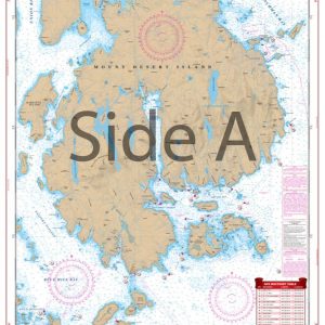
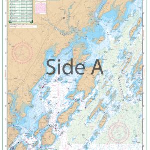
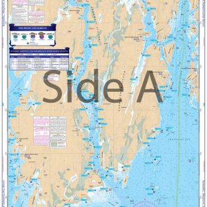
Side A has complete coverage from the mouth of Kennebunk River to Portland, with excellent coverage of Saco Bay. This chart also covers up the Saco River to Biddeford, with Richmond Island and Stratton Island, out to West Cod Ledge. Side B has good coverage inside Portland Harbor to Cape Small, and up the New Meadows River to Long Island. All of the Islands in Casco Bay as far as Maquoit Bay to the north and Halfway Rock to the south are also illustrated. On this new line of waterproof, large print charts, we have pinpointed dozens of specific areas with the major species caught in that area, such as Striped Bass, Bluefish, Tuna, Atlantic Cod, or Mackeral. We have also added bait areas and dozens of high accuracy GPS coordinates for fishing areas as well as navigational aids. An included detailed facilities guide gives you boat ramp and marina locations and even dining options while out on the water. If you are fishing this area you will want to add this to your tackle box. This is the essential fishing chart for the Maine angler. The navigation chart is full of bright colors and useful information for boaters and fishermen alike and makes an excellent framed wall piece or gift. The marine map comes folded inside a beautifully designed folder with an artist rendered cover. Now to the good stuff! This chart is double sided because there is just so much information packed into it (great for you guys!). Side A features complete coverage from the mouth of the Kennebunk River to Portland Maine, with excellent detail of Saco Bay. These marine charts also feature the area from the Saco River to Biddeford, including Richmond Island, Stratton Island, and out to West Cod Ledge. Side B is full of just as much valuable information! It contains a navigation map From Portland Harbor to Cape Small, and up the New Meadows River to Long Island. All islands in Casco Bay as far as Maquoit Bay to the north and Halfway Rock to the south are illustrated. We've detailed dozens of points of interest for anglers looking to catch striped bass, bluefish, tuna, Atlantic cod, or mackerel. We also have information on bait areas, as well as dozens of GPS coordinates for fishing areas. You will also find boat ramps, marinas, and dining options locations on this Maine fishing chart. You won't find better nautical charts than these! Information from NOAA Charts #13290. Nautical chart is 25" X 38". WGS84 - World Mercator Datum.
Additional information
| Weight | .167 oz |
|---|---|
| Dimensions | 24 × 36 in |