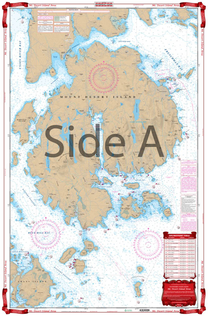

Desert Island and Area Navigation Chart 105
The Area Covered
$32.95
If you live in or plan to visit the Mount Desert Island area of Maine, you need this navigation map. You will be delighted to find that this nautical map is a combination of 4 NOAA charts. One side contains an overview of Mount Desert Island. The reverse side has coastal coverage from Isle au Haut east to Mount Desert Rock and Winter Harbor and north to Ellsworth.
The Area Covered
Detail Coverage of Mt Desert Island on one side is a combination of 3 NOAA charts. The reverse side has Coastal coverage from Isle au Haut east to Mt. Desert Rock and Winter Harbor and north to Ellsworth. Detail up the Union River to Ellsworth and of the Casco Passage. GPS Waypoints make it easy to set up your electronics. If you live in or plan to visit the Mount Desert Island area of Maine, you need this navigation map. You will be delighted to find that this nautical map is a combination of 4 NOAA charts. One side contains an overview of Mount Desert Island. The reverse side has coastal coverage from Isle au Haut east to Mount Desert Rock and Winter Harbor and north to Ellsworth. Also notice detail for the area up the Union River to Ellsworth and of the Casco Passage. GPS Waypoints make it easy to set up your electronics and find useful locations nearby. Large place names and the vibrant use of color make towns easy to find and make this navigation chart perfect for framing. Information from 4 NOAA charts; #13316, #13318, #13313 and #13312. Nautical Chart is 25" X 38". WGS84 - World Mercator Datum.
Additional information
| Weight | 0.2 oz |
|---|---|
| Dimensions | 24 × 36 in |