Charlotte Harbor and Lemon Bay Inshore Fishing Chart 1F
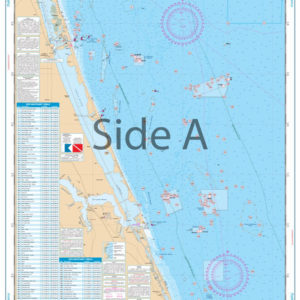
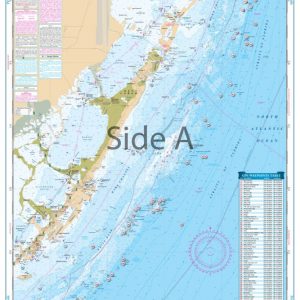
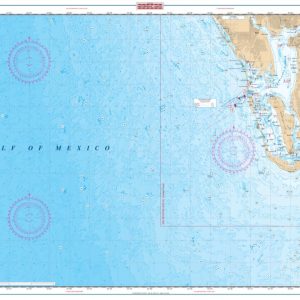
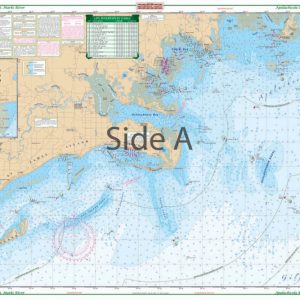
The Area Covered
$32.95
With this Charlotte Harbor and Lemon Bay nautical map, you’ll never need to flag down another boater to ask for directions again.
THIS IS A FOLDED CHART. CAN BE SHIPPED ROLLED UPON REQUEST.
The Area Covered
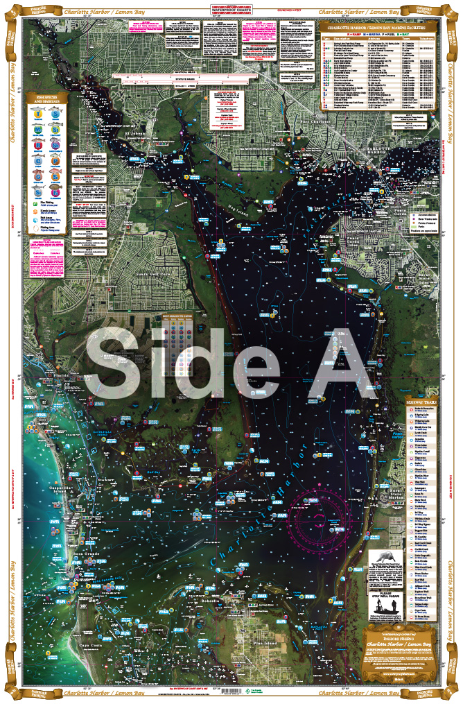
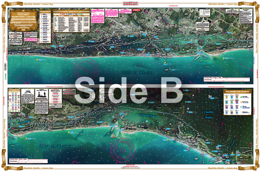
Covering all of Charlotte Harbor including Boca Grande with excellent detail of Bull and Turtle Bays, including complete coverage of Lemon Bay. This inshore chart details all of the major grass flats and pinpoints dozens of specific areas for the major species caught in the area. Also included is a handy marine facilities guide which notes popular waterfront restaurants, boat ramps, fuel docks, and bait stores. This is the one chart to have if you want to catch fish in this area. With this Charlotte Harbor and Lemon Bay nautical map, you'll never need to flag down another boater to ask for directions again. And you know how much we all dread having to ask for directions. You'll always know where you are and where you're headed because of the detail and information we put into each of our marine maps. These nautical charts cover all of Charlotte Harbor including Boca Grande with excellent detail of Bull and Turtle Bays, including complete coverage of Lemon Bay. This inshore navigation chart details all of the major grass flats and pinpoints dozens of specific areas for the major species caught in the area. Also included is a handy marine facilities guide which notes popular waterfront restaurants, boat ramps, fuel docks, and bait stores. So if you don't have a bathroom on board and someone "has to go!" you'll know just where to stop. This is the one fishing chart to have if you want to catch fish in this area. Information from 2 NOAA charts: #11425 and #11426. Nautical chart is 25" X 38". WGS84 - World Mercator Datum.
Additional information
| Weight | .167 oz |
|---|---|
| Dimensions | 24 × 36 in |