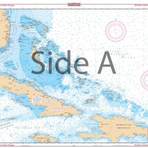
Vero to Palm Beach Navigation Chart 17
The Area Covered
$32.95
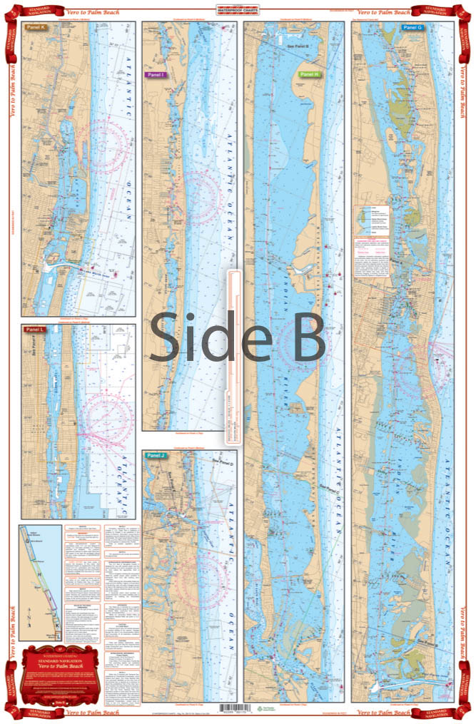
Nobody offers coastal coverage from Vero to Palm Beach quite like Waterproof Charts. You will be able to expertly navigate this coastal region with ease. We offer complete Intracoastal coverage from Wabasso south to Palm Beach in this navigation map. Colored panels are easy to see and understand.
The Area Covered
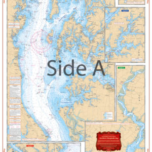
Complete Intracoastal Coverage from Wabasso south to Palm Beach. Color Keyed Panels are easy to understand. Extra Large Insets of Vero, Ft. Pierce, Stuart, Jupiter and Palm Beach on the reverse side. Nobody offers coastal coverage from Vero to Palm Beach quite like Waterproof Charts. You will be able to expertly navigate this coastal region with ease. We offer complete Intracoastal coverage from Wabasso south to Palm Beach in this navigation map. Colored panels are easy to see and understand. Extra large insets of Vero, Ft. Pierce, Stuart, Jupiter and Palm Beach are on the reverse side. If you're a long-time outdoorsman (or woman) in this area, you'll want to get this nautical map framed and hung on your wall. Information from 2 NOAA Charts: #11472 & #11428. Nautical chart is 25" X 38". WGS84 - World Mercator Datum.
Additional information
| Dimensions | 24 × 36 in |
|---|