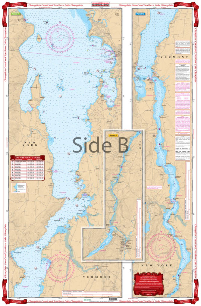
Champlain Canal and South Lake Champlain Navigation chart 11
The Area Covered
$32.95
Never panic about being lost again with this Lake Champlain map! This navigation map of the Champlain Canal up to the southern edge of Lake Champlain contains in-depth detail of this area to help keep you headed in the right direction.
The Area Covered
From the south one side starts at Troy and details the Champlain Barge Canal to Whitehall, N.Y. The Reverse Side continues north thru the Narrows of Dresden past the Crown Point Bridge and north to north of Burlington, Vt. and Port Kent, N.Y. Never panic about being lost again with this Lake Champlain map! This navigation map of the Champlain Canal up to the southern edge of Lake Champlain contains in-depth detail of this area to help keep you headed in the right direction. From the south, one side of this nautical chart starts at Troy and details the Champlain Barge Canal to Whitehall NY. The reverse side continues north thru the Narrows of Dresden past the Crown Point Bridge and north to north of Burlington VT and Port Kent NY. Be sure to order a second navigation chart to frame for your wall. If you plan to do some Lake Champlain fishing you will want to check out Waterproof Chart #11F. Information from 4 NOAA Charts; #14782, #14783, #14784, & #14786. Nautical Chart is 25" X 38". WGS84 - World Mercator Datum.
Additional information
| Weight | 0.2 oz |
|---|---|
| Dimensions | 24 × 36 in |