Lake Champlain North Lake Fishing Chart 12F
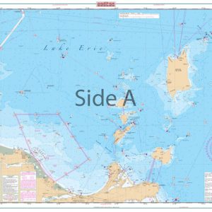
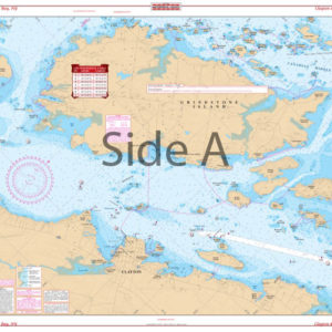
The Area Covered
$32.95
This large print Lake Champlain Fishing Chart details all of the major fishing areas and pinpoints dozens of specific areas for the popular species caught in the area. (Large and Smallmouth Bass, Yellow Perch, Walleye, Muskie, Northern Pike, Salmon, and Trout). Many areas on this navigation chart have GPS positions for added convenience.
THIS IS A FOLDED CHART.
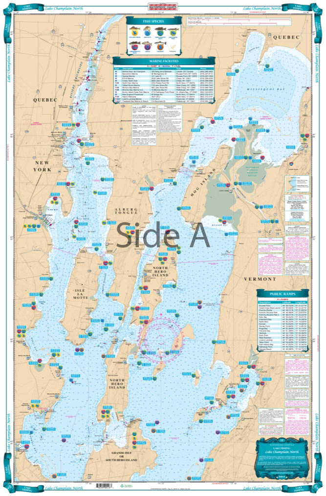
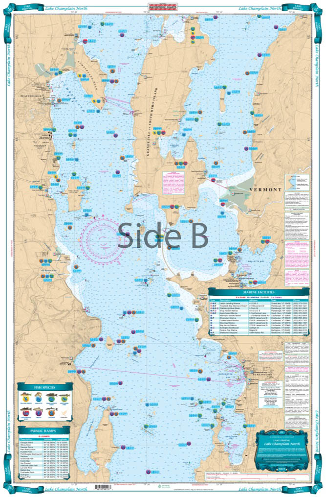
The Area Covered
This Lake Chart details all of the Major Fishing Areas and pinpoints dozens of specific areas for the major species caught in the area. (Large and Smallmouth Bass, Yellow Perch, Walleye, Muskie, Northern Pike, Salmon & Trout). Many areas have GPS positions. Grass and Marsh areas are also identified. Marinas are listed as well as popular Boat Ramps. Starting at Willsboro and Shelburne Points coverage is north to and including Missisquoi Bay and the Rt 202 Bridge on the Richelieu River in Canada. Includes Malletts Bay and all of the Champlain Islands. This large print Lake Champlain Fishing Chart details all of the major fishing areas and pinpoints dozens of specific areas for the popular species caught in the area. (Large and Smallmouth Bass, Yellow Perch, Walleye, Muskie, Northern Pike, Salmon, and Trout). Many areas on this navigation chart have GPS positions for added convenience. Grass and marsh areas are also identified (these can be great areas for fishing). Marinas are listed as well as popular boat ramps to help you get in and out of the water. These fishing charts contain the area starting at Willsboro and Shelburne Points, coverage is north to Missisquoi Bay and the Route 202 Bridge on the Richelieu River in Canada. Includes Malletts Bay and all of the Champlain Islands. Get this vibrantly colored navigation chart framed for your home or office. Information from 2 NOAA Charts: #14782 & #14781. Nautical Chart is 25" X 38". WGS84 - World Mercator Datum.
Additional information
| Dimensions | 24 × 36 in |
|---|