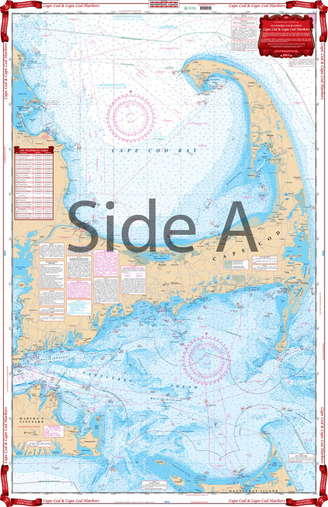
Cape Cod and Harbors Navigation Chart 64
The Area Covered
$32.95
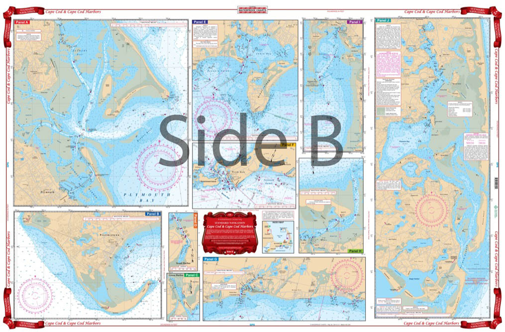
A creative combination of government charts allows coverage of all of Cape Cod on a single side, from Provincetown south to Nantucket and west to Falmouth. Large print place names make areas and towns very easy to find. GPS Waypoints are printed directly on the chart. The reverse side has 10 enlarged blow ups for the following habors: Chatham and Pleasant Bay, South Yarmouth, West Dennis and Harwich Port, Barnstable, Wellfleet, Woods Hole and Falmouth, Hyannis, Plymouth and Provincetown.
The Area Covered
A creative combination of government charts allows coverage of all of Cape Cod on a single side, from Provincetown south to Nantucket and west to Falmouth. Large print place names make areas and towns very easy to find. GPS Waypoints are printed directly on the chart. The reverse side has 10 enlarged blow ups for the following habors: Chatham and Pleasant Bay, South Yarmouth, West Dennis and Harwich Port, Barnstable, Wellfleet, Woods Hole and Falmouth, Hyannis, Plymouth and Provincetown. An excellent color key makes these insets easy to find. This nautical map is a creative combination of 8 NOAA charts, allowing for coverage of all of Cape Cod on a single side, from Provincetown south to Nantucket and west to Falmouth. This chart is perfect for planning a journey through the waters of Cape Cod. Large print place names make areas and towns very easy to find. GPS Waypoints are printed directly on the navigation chart. Just plug them into your GPS unit and you're ready to go. The reverse side has 10 enlarged blow ups for the following habors: Chatham and Pleasant Bay, South Yarmouth, West Dennis and Harwich Port, Barnstable, Wellfleet, Woods Hole and Falmouth, Hyannis, Plymouth and Provincetown. An excellent color key makes these insets easy to find. You will find this navigation map excellent for framing and displaying in your home or office. Information from 8 different NOAA Charts: #13246, #13237, #13248, #13229, #13250, #13249, #13251, and #13253. Nautical Chart is 25" X 38". WGS84 - World Mercator Datum.
Additional information
| Dimensions | 24 × 36 in |
|---|