Peace and Myakka Rivers Large Print Navigation Chart 4E
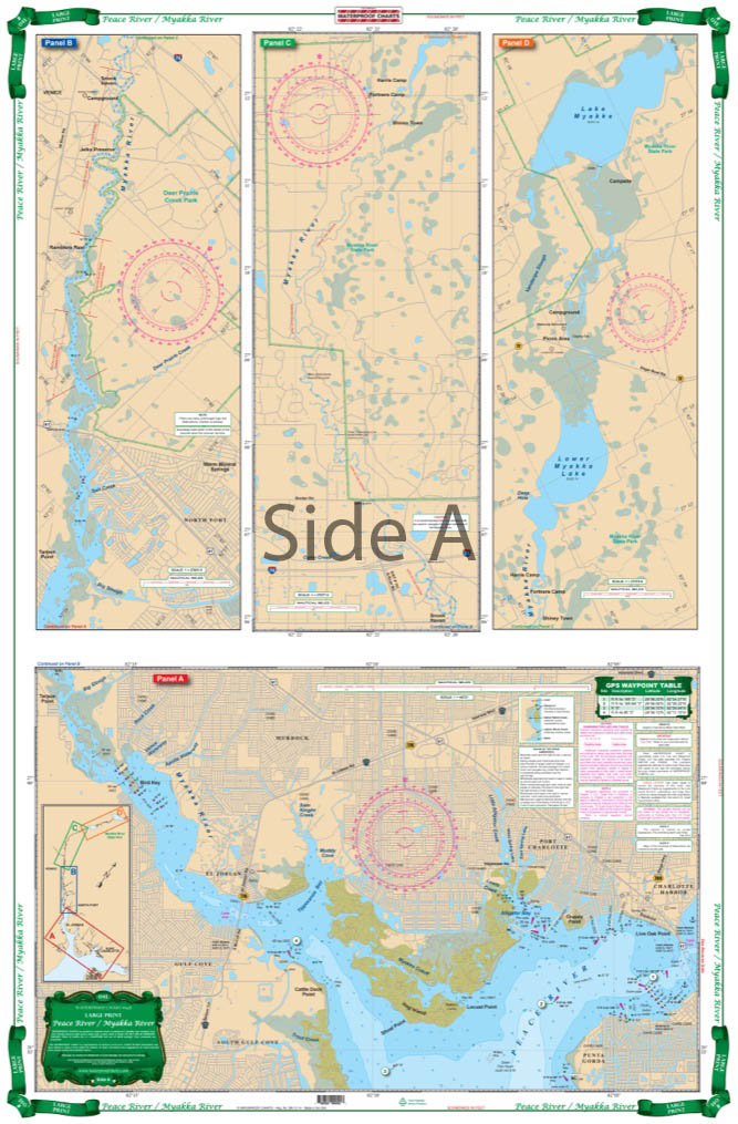
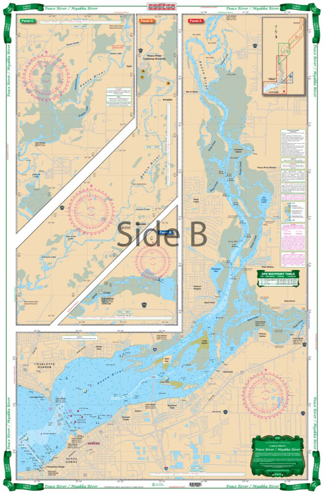
The Area Covered
$32.95
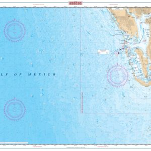
Covers the Peace River from Arcadia south to Charlotte Harbor and the Myakka River from Myakka River State Park. Depths from upstream of I-75 Bridge to Charlotte Harbor. Detail of North Charlotte Harbor south to Ponce DeLeon Park. Information from NOAA 11426 and USGS maps and ISS field surveys. Colored Key. The Peace River and Mayakka River are wonderful places to kayak, camp, canoe, boat, and fish.
The Area Covered
Covers the Peace River from Arcadia south to Charlotte Harbor and the Myakka River from Myakka River State Park. Depths from upstream of I-75 Bridge to Charlotte Harbor. Detail of North Charlotte Harbor south to Ponce DeLeon Park. Information from NOAA 11426 and USGS maps and ISS field surveys. Colored Key. The Peace River and Mayakka River are wonderful places to kayak, camp, canoe, boat, and fish. To expertly navigate this area, we have the perfect nautical map for you. This navigation map covers the Peace River from Arcadia south to Charlotte Harbor and the Myakka River from Myakka River State Park. Depths are included from upstream of I-75 Bridge to Charlotte Harbor. Detail of North Charlotte Harbor south to Ponce DeLeon State Park. Information from NOAA Chart #11426 and USGS maps and ISS field surveys. You will love this navigation chart so much, you will want to frame it and display it in your home or office. Nautical Chart is 25" X 38". WGS84 - World Mercator Datum.
Additional information
| Dimensions | 24 × 36 in |
|---|