Caribbean and Gulf of Mexico Planning Chart 4
The Area Covered
$34.95
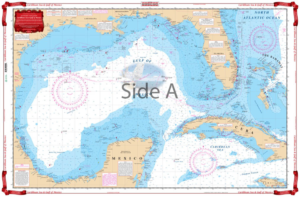
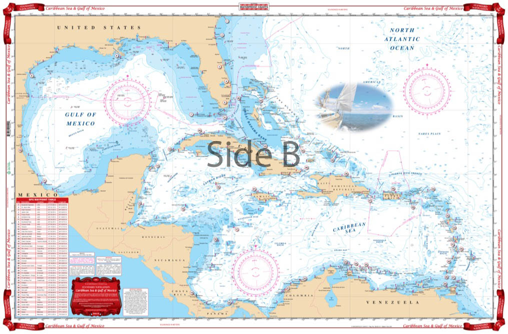
A terrific nautical chart for planning and passage making. Especially suited for framing with excellent colors and readability.The large area, small scale side covers from Bermuda South to Barbados, Trinidad and the North coast of South America, and West to the Panama canal and includes the entire East coasts of Costa Rica, Nicaragua, Honduras, Guatamala, Belize, and Mexico. The reverse side offers more detailed coverage from Florida and the Bahamas South to Jamaica and West to Mexico.
The Area Covered
A terrific chart for planning and passage making. Especially suited for framing with excellent colors and readability.The large area, small scale side covers from Bermuda South to Barbados, Trinidad and the North coast of South America, and West to the Panama canal and includes the entire East coasts of Costa Rica, Nicaragua, Honduras, Guatamala, Belize, and Mexico. The reverse side offers more detailed coverage from Florida and the Bahamas South to Jamaica and West to Mexico. A table of GPS coordinates for the major lighthouses is provided. Information from 2 very popular charts: NOAA #411 and DMA #400. Explore the Caribbean and Gulf of Mexico with this comprehensive navigation map. This nautical chart covers a large area from Bermuda to Barbados in the east, Trinidad to the north coast of South America, and west to the Panama Canal. This marine map also includes the entire east coast of Costa Rica, Nicaragua, Honduras, Guatemala, Belize, and Mexico. The reverse side offers a more detailed view from Florida and the Bahamas to Jamaica, and west to Mexico. A convenient table of GPS coordinates also includes major lighthouses. This information comes from NOAA Charts #411 and DMA #400. The navigation chart size is 25" x 38". WGS84 - World Mercator Datum
Additional information
| Weight | 0.2 oz |
|---|---|
| Dimensions | 24 × 36 in |