Lake Okeechobee Stuart to Fort Myers Beach Crossing Navigation Chart 20
The Area Covered
$32.95
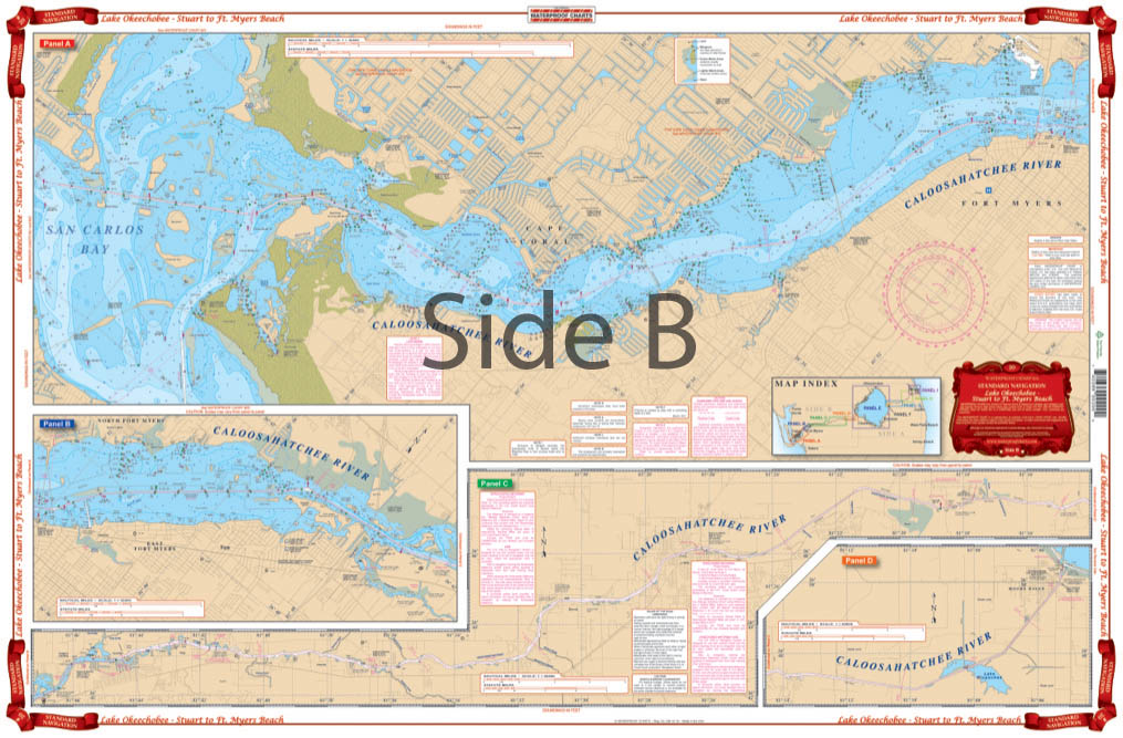
Side A begins on the East Coast of Florida at the St. Lucie Inlet and continues through the St. Lucie River, the St. Lucie Canal, and Lake Okeechobee (including the Rim Canal). It includes local names of Lake features. Side B provides extra large blown up coverage from the Lake west through Ft. Myers to Sanibel and Ft. Myers Beach.
The Area Covered
Side A begins on the East Coast of Florida at the St. Lucie Inlet and continues through the St. Lucie River, the St. Lucie Canal, and Lake Okeechobee (including the Rim Canal). It includes local names of Lake features. Side B provides extra large blown up coverage from the Lake west through Ft. Myers to Sanibel and Ft. Myers Beach. Color coded index key makes panel layout easy to understand. Big place names make towns easy to find. You might as well get back on the dock and go home if you don't have this nautical map. If you want to be confident about where you're headed and just how to get there, you need our Lake Okeechobee to Fort Myers nautical chart. Side A begins on the East Coast of Florida at the St. Lucie Inlet and continues through the St. Lucie River, the St. Lucie Canal, and Lake Okeechobee (including the Rim Canal). It includes local names of lake features. Side B provides extra large blown up coverage from the Lake Okeechobee west through Ft. Myers to Sanibel and Ft. Myers Beach. A color coded index key makes the panel layout easy to understand. Big place names make towns easy to find. Trust us, you will love this navigation chart so much, you'll want a second framed on your office wall. Information from 3 NOAA Charts: #11427, #11428 and #11472. GPS Datum. Nautical chart is 25" X 38". WGS84 - World Mercator Datum.
Additional information
| Weight | 0.2 oz |
|---|---|
| Dimensions | 24 × 36 in |