
Punta Gorda and Port Charlotte Canals Large Print Navigation Chart 3E
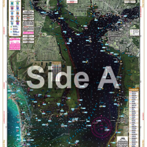
The Area Covered
$32.95
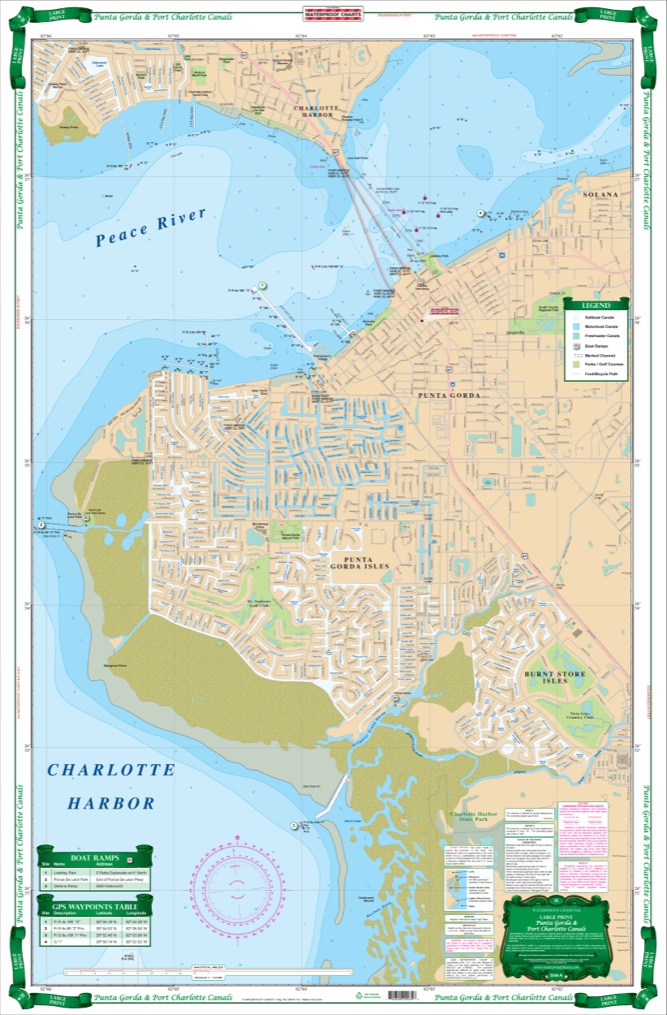
Coverage available from no other source. Current information compiled from Charlotte County GIS, USGS topographic data and NOAA charts. Detailed coverage of both city and county canal systems and the head of Charlotte Harbor and the Mayakka River up to the El Jobean Bridge with current channel entrances, waterway names and bridge and lock information. Defines sailboat (no bridges) and powerboat only waterways with different colors. Easy to read with great colors, suitable for framing.
The Area Covered
Coverage available from no other source. Current information compiled from Charlotte County GIS, USGS topographic data and NOAA charts. Detailed coverage of both city and county canal systems and the head of Charlotte Harbor and the Mayakka River up to the El Jobean Bridge with current channel entrances, waterway names and bridge and lock information. Defines sailboat (no bridges) and powerboat only waterways with different colors. Easy to read with great colors, suitable for framing. If you live in or visit this area, this is the one chart to have. Coverage like this is available from no other source. Every one of our navigation charts are created from a variety of sources like NOAA charts, government data, and locals. This Port Charlotte map is no exception. Current information has been compiled from Charlotte County GIS, USGS topographic data and NOAA charts. Detailed coverage of both city and county canal systems and the head of Charlotte Harbor and the Mayakka River up to the El Jobean Bridge with current channel entrances, waterway names and bridge and lock information. Our chart defines sailboat (no bridges) and powerboat only waterways with different colors. Easy to read, with great colors that make this nautical map suitable for framing. If you live in or visit this area, this is the one chart to have. Nautical Chart is 25" X 38". WGS84 - World Mercator Datum.
Additional information
| Dimensions | 24 × 36 in |
|---|