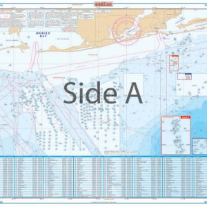
Southwest Florida Offshore Fish and Dive Chart 15F
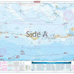
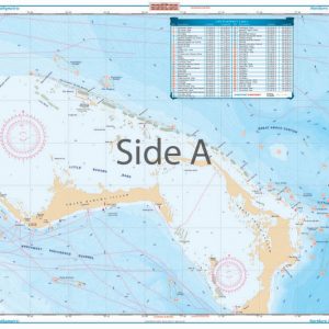
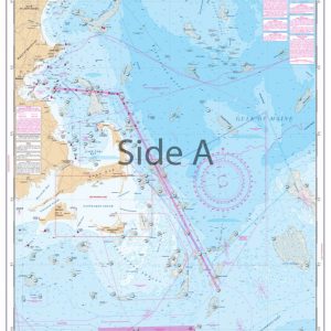
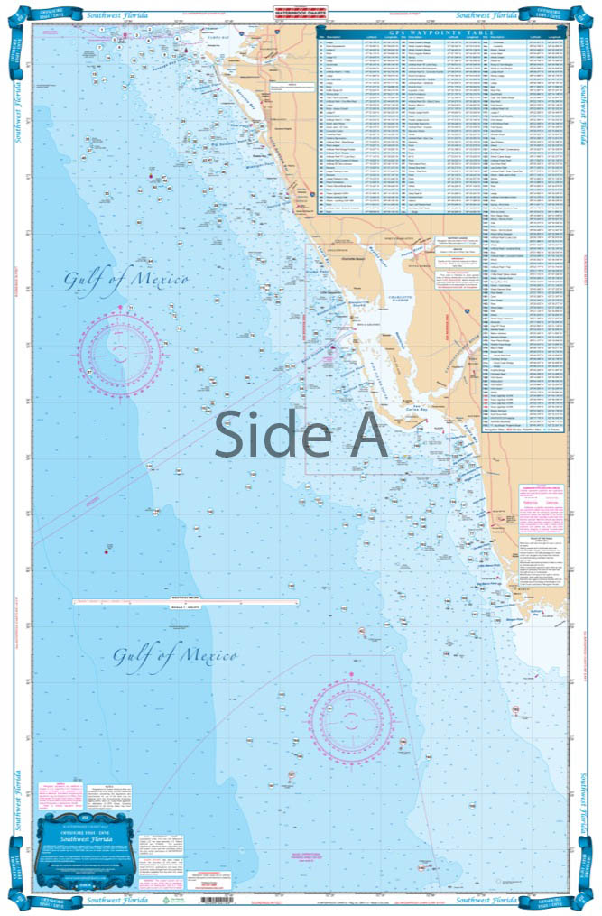
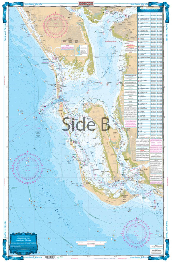
The Area Covered
$32.95
If you plan to go fishing off the Southwest Florida coast, you must have this waterproof, tear-resistant fishing chart. Besides being ultra-durable, this navigation map includes key information for fishermen in this area.
The Area Covered
Complete offshore coverage from Tampa Bay to 50 Miles South of Marco Island. Reverse side provides coastal coverage from Englewood south to Ft. Myers Beach with complete depths for Charlotte Harbor, Pine Island Sound, and Matlacha Pass. A total of 281 plotted and indexed GPS Waypoints for reefs, wrecks, lights, fishing spots, and diving areas. If you plan to go fishing off the Southwest Florida coast, you must have this waterproof, tear-resistant fishing chart. Besides being ultra-durable, this navigation map includes key information for fishermen in this area. Complete offshore coverage runs from Tampa Bay to 50 Miles South of Marco Island. The reverse side provides coastal coverage from Englewood south to Ft. Myers Beach with complete depths for Charlotte Harbor, Pine Island Sound, and Matlacha Pass. A total of 281 plotted and indexed GPS Waypoints for reefs, wrecks, lights, fishing spots, and diving areas. You are sure to find a spot with tons of huge fish using this fishing chart. You will love it so much, you'll need another to have framed in your office or home. Information from 2 NOAA Charts: #11426 & #11420. Nautical chart is 25" X 38". WGS84 - World Mercator Datum.
Additional information
| Dimensions | 24 × 36 in |
|---|