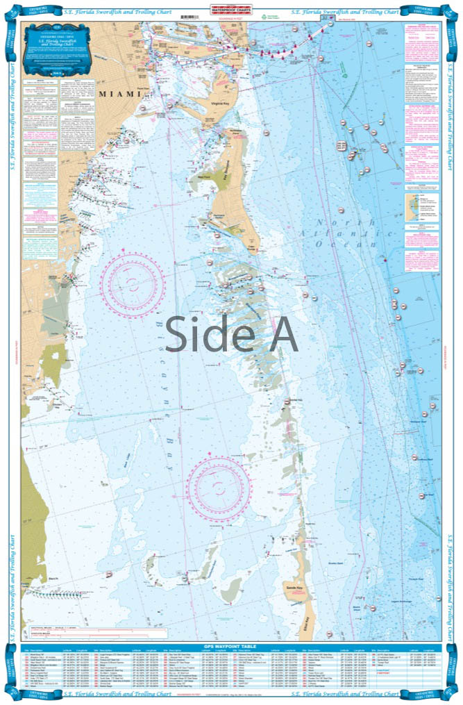

Southeast Florida Swordfish and Trolling Fish and Dive Chart 123F
The Area Covered
$32.95
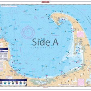
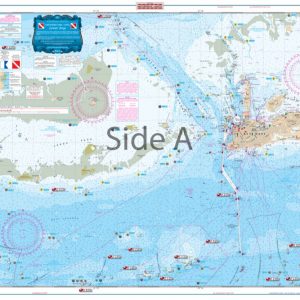
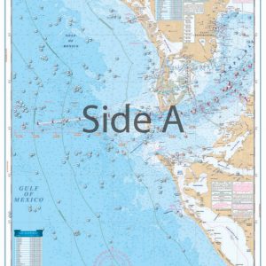
Are you an avid fishermen or planning to visit Southeast Florida? You’ll need this swordfish and trolling offshore fishing chart. No nautical chart does it better than this! Coverage runs from Ft. Pierce south to Key Largo and offshore to the West Bahamas. Highlighted are popular trolling areas with their local names which provide the structure for the best deep water fishing including Sailfish Alleys, Swordfish, Haulover and Holy Grounds, The Zoo, Tuna City, and Bimini Blue Marlin Grounds.
The Area Covered
Coverage from Ft. Pierce south to Key Largo and offshore to the West Bahamas. Highlighted are popular trolling areas with their local names which provide the structure for the best deep water fishing including Sailfish Alleys, Swordfish, Haulover and Holy Grounds, The Zoo, Tuna City, and Bimini Blue Marlin Grounds. Over 100 GPS coordinates provide targets for trolling fishermen. The reverse side is coverage from North Miami to Elliot Key with inshore detail and has listings for 70 popular wrecks and reefs, all with GPS coordinates. Are you an avid fishermen or planning to visit Southeast Florida? You'll need this swordfish and trolling offshore fishing chart. No nautical chart does it better than this! Coverage runs from Ft. Pierce south to Key Largo and offshore to the West Bahamas. Highlighted are popular trolling areas with their local names which provide the structure for the best deep water fishing including Sailfish Alleys, Swordfish, Haulover and Holy Grounds, The Zoo, Tuna City, and Bimini Blue Marlin Grounds. Over 100 GPS coordinates provide targets for trolling fishermen. The reverse side has coverage from North Miami to Elliot Key with inshore detail and has listings for 70 popular wrecks and reefs, all with GPS coordinates. A total of 170 numbers! You won't get bored of this navigation map! If you're fishing for swordfish, dolphin, wahoo, tuna, marlin, sailfish, or kingfish in SE Florida, this is the ONE navigation chart to have. Nautical Chart is 25" X 38". WGS84 - World Mercator Datum.
Additional information
| Dimensions | 24 × 36 in |
|---|