Bluefin, Georges, Canyons Maxi Offshore Fishing Chart 164F
$32.95
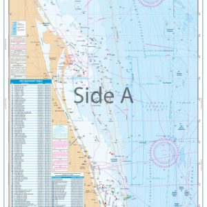
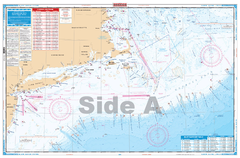
This new chart is for the Offshore Fisherman that targets the Canyons from MA to NC. Side A lists 24 Canyons starting with Georges Canyon to Toms Canyon. Canyons are listed by name with Latitude & Longitude Coordinates. Also included are known fishing areas such as Rodgers Basin, Franklin Basin, Mayo Swell, Cultivator Shoal and many others.
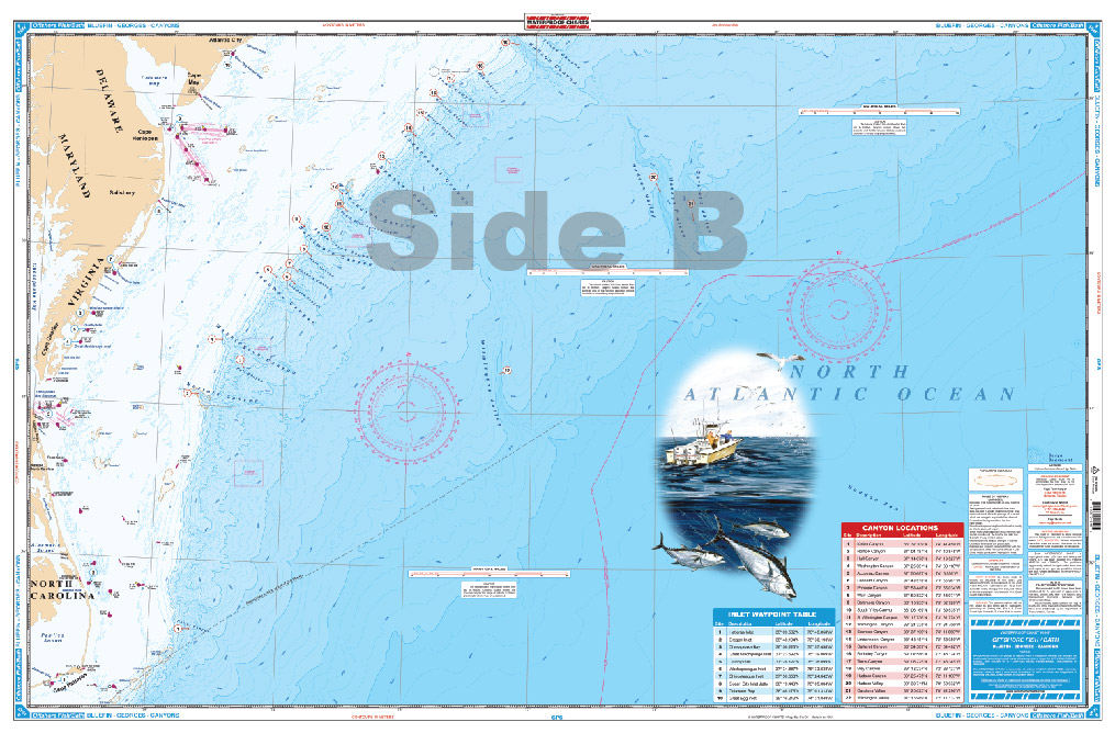
This new chart is for the Offshore Fisherman that targets the Canyons from MA to NC. Side A lists 24 Canyons starting with Georges Canyon to Toms Canyon. Canyons are listed by name with Latitude & Longitude Coordinates. Also included are known fishing areas such as Rodgers Basin, Franklin Basin, Mayo Swell, Cultivator Shoal and many others. In addition to the Canyons there are 16 Inlet Waypoint locations that are listed by name and position. Side B continues south from the Hudson Canyon to Keller Canyon. All 22 Canyons are listed by name and GPS coordinates as well as an inlet table. If you're an Offshore Fisherman that targets big fish then this is the chart for you. Chart is 25" X 38". WGS84 - World Mercator Datum.
Additional information
| Dimensions | 24 × 36 in |
|---|