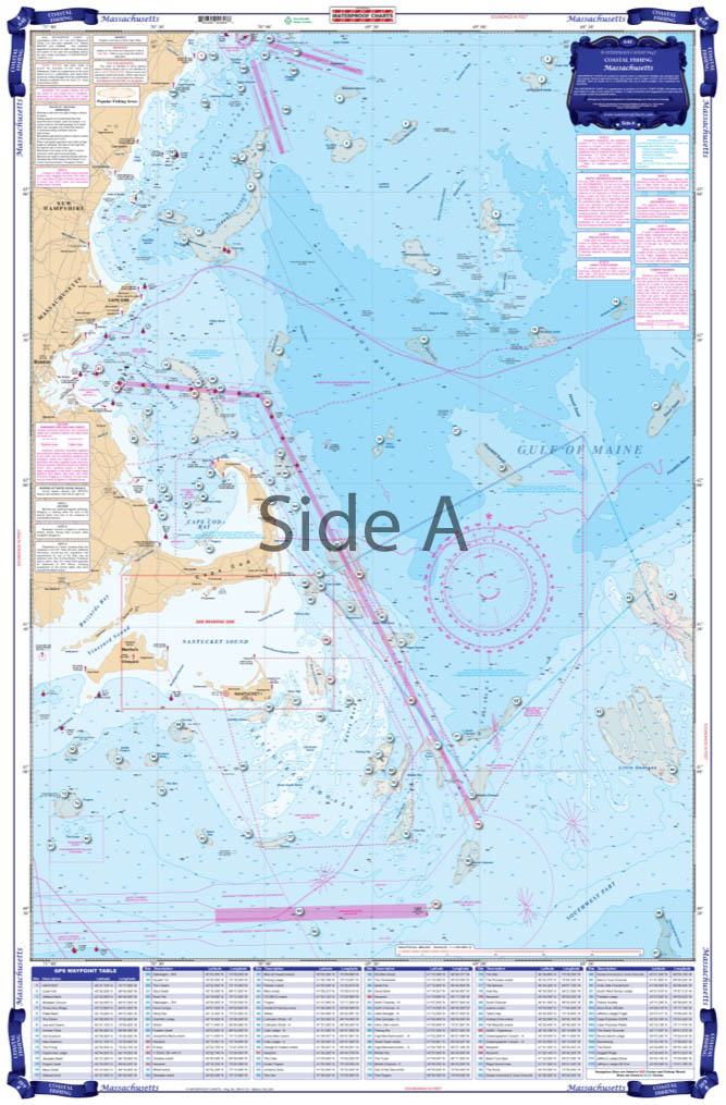
Massachusetts Coastal Fishing Chart 64F
The Area Covered
$32.95
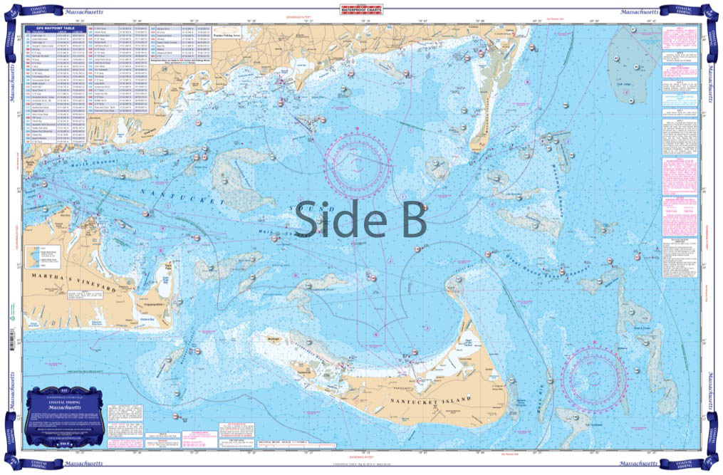
An exceptionally clear, uncluttered, and easy to use chart. Side one has great detailed coverage of the south side of Cape Cod and Nantucket Sound with major sportfish grounds highlighted. Over 60 GPS Waypoints on this side guide you to fishing grounds, wrecks and navigation markers. Each waypoint is accurately plotted on the chart with its local name so you can see their relative position and plan your trip.
The Area Covered
An exceptionally clear, uncluttered, and easy to use chart. Side one has great detailed coverage of the south side of Cape Cod and Nantucket Sound with major sportfish grounds highlighted. Over 60 GPS Waypoints on this side guide you to fishing grounds, wrecks and navigation markers. Each waypoint is accurately plotted on the chart with its local name so you can see their relative position and plan your trip. The reverse side shows the offshore grounds from over 40 miles south of Martha's Vineyard east to Little Georges Bank and north to the New Hampshire/Maine border with over 90 plotted positions for sportfish grounds, wrecks, and navigation buoys. Includes both Stellwagen Bank and Jefferys Ledge. Over 150 total GPS coordinates. This is an exceptionally clear, uncluttered, and easy to use Massachusetts fishing chart. Side A has great detailed coverage of the south side of Cape Cod and Nantucket Sound with major sportfishing grounds highlighted. Over 60 GPS Waypoints on this side guide you to fishing grounds, wrecks and navigation markers. Each waypoint is accurately plotted on the fishing chart with its local name so you can see their relative position and plan your trip. The reverse side shows the offshore grounds from over 40 miles south of Marthas Vineyard east to Little Georges Bank and north to the New Hampshire and Maine border with over 90 plotted positions for sportfish grounds, wrecks, and navigation buoys. This navigation chart also includes both Stellwagen Bank and Jefferys Ledge. Over 150 total GPS coordinates in all! Use this nautical map to plan your next fishing trip, or frame it to display in your home or office. Information from 2 NOAA charts: #13237 and #13009. Nautical Chart is 25" X 38". WGS84 - World Mercator Datum.
Additional information
| Dimensions | 24 × 36 in |
|---|