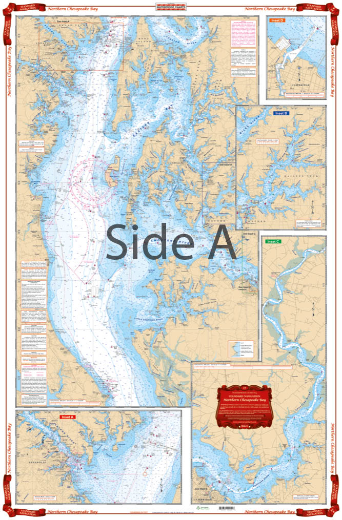

Northern Chesapeake Bay Navigation Chart 24
The Area Covered
$32.95
Complete coverage from the C& D canal south past Annapolis to the Choptank River and Cove Point. Eight Details for Chester River, Baltimore Harbor, Magothy River, Rock Hall Harbor, Annapolis, Cambridge, the Tred Avon River, the Choptank River. Colored Keys on both sides make it easy to understand. A total of 19 Plotted and Indexed GPS WAYPOINTS.
The Area Covered
Complete coverage from the C& D canal south past Annapolis to the Choptank River and Cove Point. Eight Details for Chester River, Baltimore Harbor, Magothy River, Rock Hall Harbor, Annapolis, Cambridge, the Tred Avon River, the Choptank River. Colored Keys on both sides make it easy to understand. A total of 19 Plotted and Indexed GPS WAYPOINTS. You won't find a better nautical map for the northern Chesapeake Bay, seriously! This navigation chart has been derived from 7 NOAA charts. Complete coverage runs from the C&D Canal south past Annapolis to the Choptank River and Cove Point. Eight details are included for Chester River, Baltimore Harbor, Magothy River, Rock Hall Harbor, Annapolis, Cambridge, the Tred Avon River, the Choptank River. Colored keys on both sides of this navigation map make it easy to understand. A total of 19 Plotted and Indexed GPS waypoints will help you locate points of interest. You'll enjoy this Chesapeake Bay map so much, you'll want one for the boat and one to frame. Information from 7 different NOAA Charts; #12263, #12266, #12268, #12270, #12278, #12272, & #12273. Nautical chart is 25" X 38". WGS84 - World Mercator Datum.
Additional information
| Weight | 0.2 oz |
|---|---|
| Dimensions | 24 × 36 in |