Big Bend Offshore Fish and Dive Chart 18F
The Area Covered
$32.95
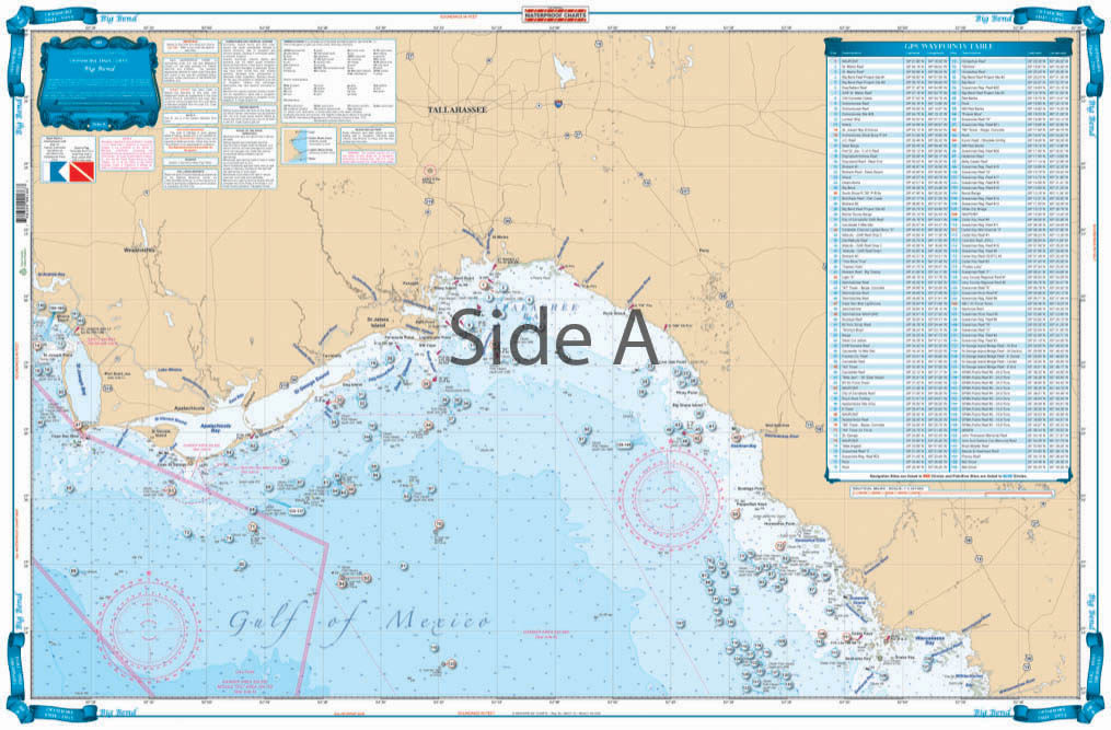
For you northwest Florida boaters and fishermen, we have the nautical chart for you. No matter if you are fishing from a kayak or a 30 foot powerboat, these waterproof, tear-resistant fishing charts are durable enough and easy to read for any situation. This fishing chart offers complete offshore coverage of the Big Bend area.
The Area Covered
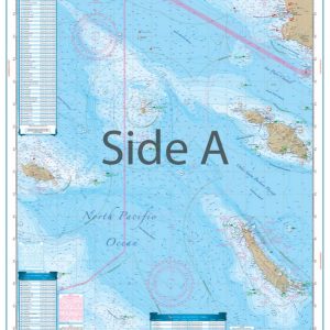
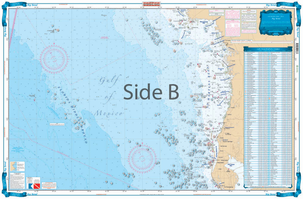
COMPLETE OFFSHORE COVERAGE. SIDE "A" HAS CONTINUOS COVERAGE FROM THE WITHLACOOCHEE RIVER NW THROUGH APALACHEE BAY WEST TO CAPE SAND BLAS / ST JOSEPH BAY. THIS CHART COVERS 50 MILES OFFSHORE FROM APALACHEEBAY WITH 164 PLOTTED WRECKS, REEFS AND DIVE SITES BY NAME AS WELL AS LATTITUDE AND LONGITUDE. SIDE "B" HAS COMPLETE COVERAGE FROM ST. PETERSBURG NORTH TO THE CEDER KEYS. THE CHART COVERS 100 MILES OFFSHORE INCLUDING THE "FLORIDA MIDDLE GROUNDS". THIS SIDE HAS OVER 235 WRECKS, REEFS AND DIVE SITES BY NAME AS WELL AS LATTITUDE AND LONGITUDE. IF YOU ARE SERIOUS ABOUT FISHING OFFSHORE OF THE FLORIDA BIG BEND THIS IS A MUST HAVE CHART. For you northwest Florida boaters and fishermen, we have the nautical chart for you. No matter if you are fishing from a kayak or a 30 foot powerboat, these waterproof, tear-resistant fishing charts are durable enough and easy to read for any situation. This fishing chart offers complete offshore coverage of the Big Bend area. Side A has continuous coverage from the Withlacoochee River northwest through Apalachee Bay west to Cape Sand Blas/ St. Joseph Bay. This navigation chart covers 50 miles offshores from Apalachee Bay. This chart isn't just for navigating, it also includes 164 plotted wrecks, reefs, and dive sites by names, as well as latitude and longitude. Side B has complete coverage from St. Petersburg north to the Ceder Keys. This nautical map covers 100 miles offshore including the "Florida Middle Grounds". This side has over 235 plotted wrecks, reefs, and dive sites by name. For the serious fishermen, there is not fishing chart quite like this one. NOAA charts #11400. Chart is 25" X 38". WGS84 - World Mercator Datum.
Additional information
| Dimensions | 24 × 36 in |
|---|