British Virgin Islands Navigation Chart 32B
The Area Covered
$34.95
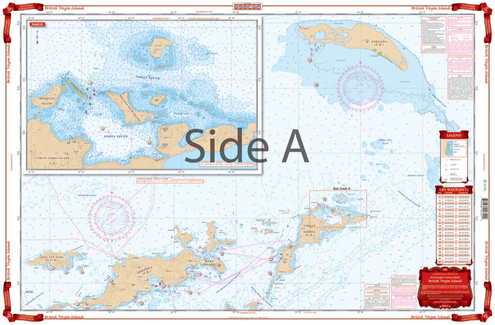
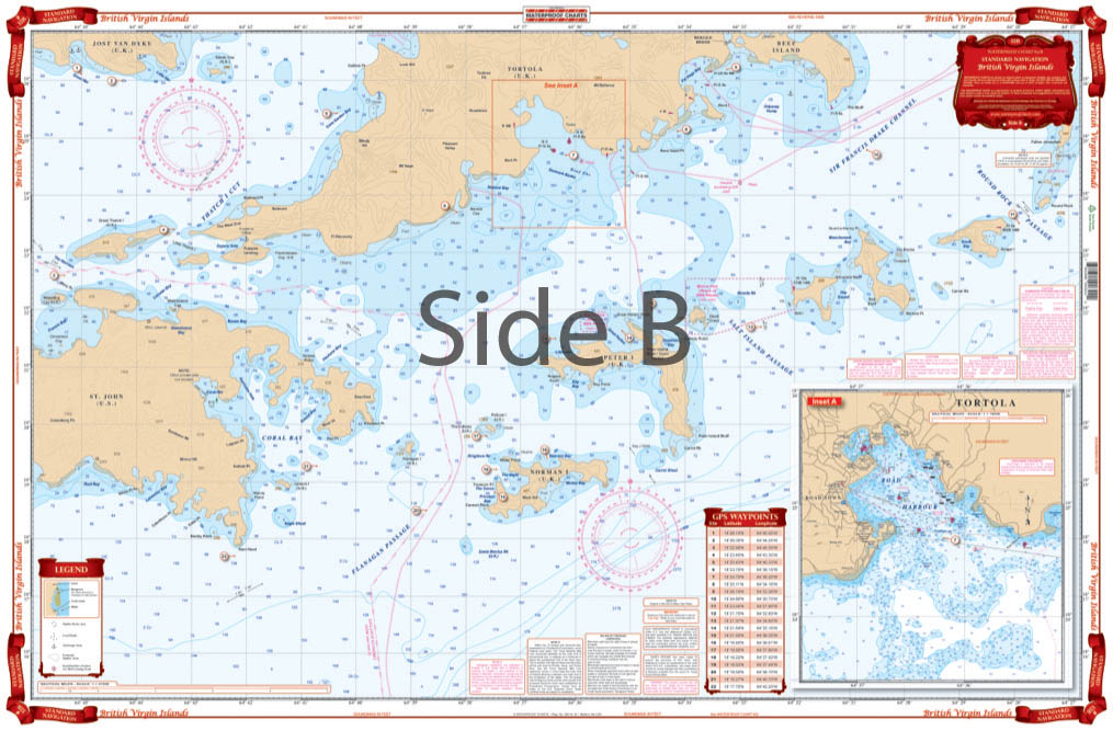
Coverage from St. John and Jost Van Dyke east and north to Virgin Gorda and Anegada. Detailed insets for Gorda Sound show in recent construction and for Road Harbor. Large Print coverage of the Sir Francis Drake Channel and Norman, Peter, Salt, Cooper and Ginger Islands.
The Area Covered
Coverage from St. John and Jost Van Dyke east and north to Virgin Gorda and Anegada. Detailed insets for Gorda Sound show in recent construction and for Road Harbor. Large Print coverage of the Sir Francis Drake Channel and Norman, Peter, Salt, Cooper and Ginger Islands. This Brish Virgin Islands map is a boater's dream. The bright, vibrant colors and large text make it easy to comprehend. It includes coverage from St. John and Jost Van Dyke east and north to Virgin Gorda and Anegada. Detailed insets for Gorda Sound show recent construction, as well as Road Harbor. We've also included large print coverage of the Sir Francis Drake Channel and Norman, Peter, Salt, Cooper and Ginger Islands. Get this handsome navigation map framed on your home or office wall. It will surely impress your friends or coworkers, and at the very least be a conversation starter. Information from DMA Charts: #25609, #25610 & #25611. Nautical chart is 25" X 38". WGS84 - World Mercator Datum.Mercator Datum.
Additional information
| Dimensions | 24 × 36 in |
|---|