Penobscot Bay Camden and Rockport Navigation Chart 103
The Area Covered
$32.95
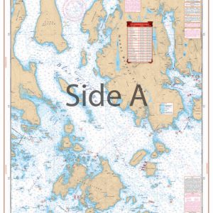
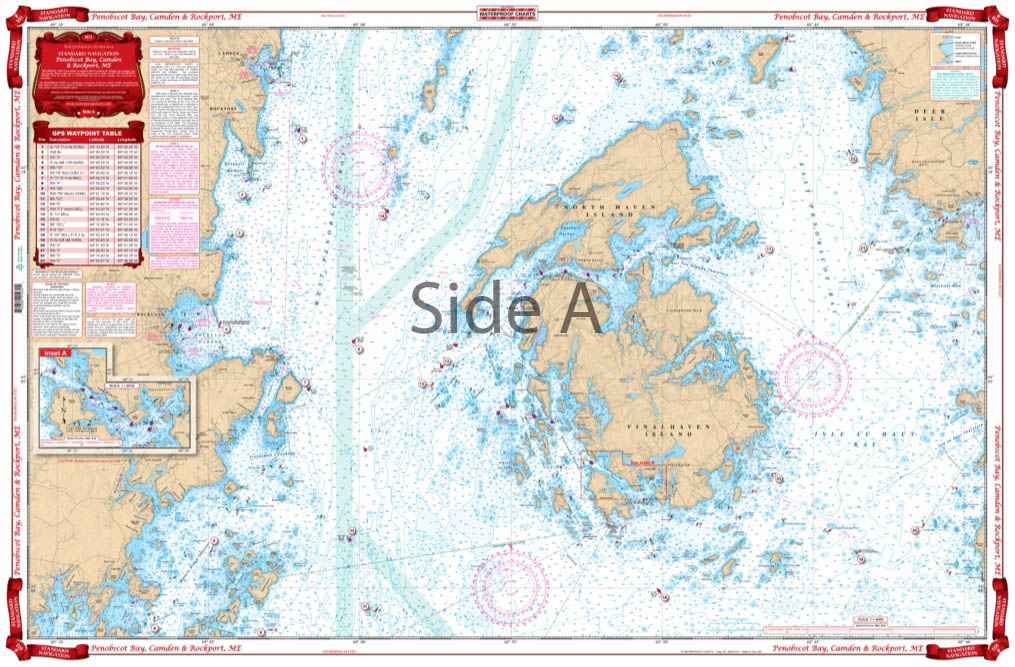
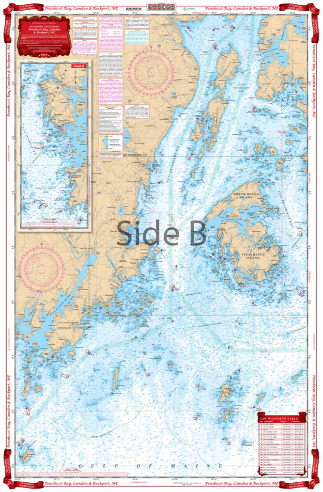
Hey Maine boaters! We’ve got the coastal nautical chart you need in your boating bag. Both coastal and detailed coverage are included for this popular cruising area. On one side is overall coverage from Monhegan to Manticus Islands and north to Castine. The reverse side of this essential navigation map covers Vinalhaven and Rockland Rockport and Camden Maine in detail with a special inset just for Carvers Harbor.
The Area Covered
Both coastal and detail coverage of this popular cruising area. On one side is overall coverage from Monhegan to Manticus Islands and north to Castine. Reverse side covers Vinalhaven and Rockland Rockport and Camden in detail with inset for Carvers Harbor. 43 GPS Waypoints make it easy to program your unit. Brighter yellow land is easy to read and bigger place names are easy to find. Information from NOAA Chart #13302 and #13305. Hey Maine boaters! We've got the coastal nautical chart you need in your boating bag. Both coastal and detailed coverage are included for this popular cruising area. On one side is overall coverage from Monhegan to Manticus Islands and north to Castine. The reverse side of this essential navigation map covers Vinalhaven and Rockland Rockport and Camden Maine in detail with a special inset just for Carvers Harbor. The 43 GPS Waypoints make it easy to program your GPS unit for useful spots in the area. The vibrant colors and large fonts make these marine charts easy to read while out on the water. These same colors make this navigation chart excellent for framing. Information from NOAA Charts #13302 and #13305. Nautical Chart is 25" X 38". WGS84 - World Mercator Datum.
Additional information
| Weight | 0.2 oz |
|---|---|
| Dimensions | 24 × 36 in |