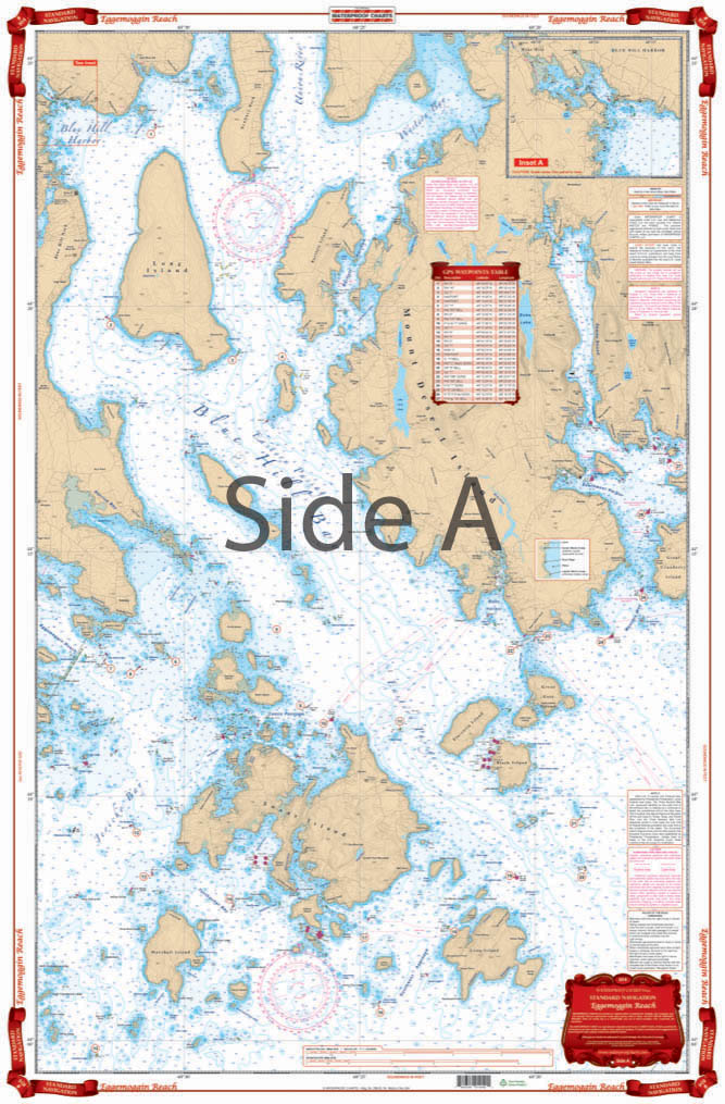
Eggemoggin Reach to Blue Hill Navigation Chart 104
The Area Covered
$32.95
Calling all Maine boaters, fishermen, kayakers, anyone who loves the water, we have a treat for you! This navigation map is a great combination of 4 NOAA charts, making it easy to see this complex area. Travel from Vinylhaven completely thru either Eggemoggin Reach or Deer Isle Thorofare on one side.
The Area Covered
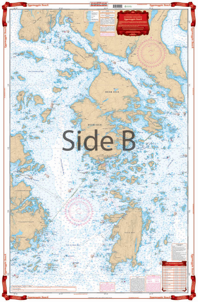
A great combination of 4 charts makes it easy to see this complex area. Travel from Vinylhaven completely thru either Eggemoggin Reach or Deer Isle Thorofare on one side. Large Place names make towns easy to find. Reverse side covers Blue Hill Bay to Northwest and Southwest Harbors Includes Detail for Blue Hill Harbor. Waypoints for GPS. Information from 4 NOAA charts; #13309, #13305, #13313, and #13316. Calling all Maine boaters, fishermen, kayakers, anyone who loves the water, we have a treat for you! This navigation map is a great combination of 4 NOAA charts, making it easy to see this complex area. Travel from Vinylhaven completely thru either Eggemoggin Reach or Deer Isle Thorofare on one side. Large place names and vibrant colors make towns easy to find, and also make this chart excellent for framing. The reverse side covers Blue Hill Bay to Northwest and Southwest Harbors. The nautical chart also includes detail for Blue Hill Harbor. Don't forget to check out waypoints for GPS. Easily input them into your GPS unit and explore these useful areas. Information from 4 NOAA charts; #13309, #13305, #13313, and #13316. Nautical Chart is 25" X 38". WGS84 - World Mercator Datum.
Additional information
| Weight | 0.2 oz |
|---|---|
| Dimensions | 24 × 36 in |