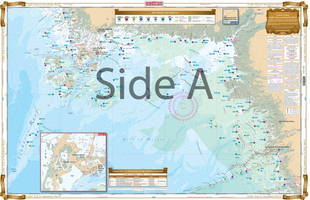
Cedar Key to Suwannee River Inshore Fishing Chart 30F
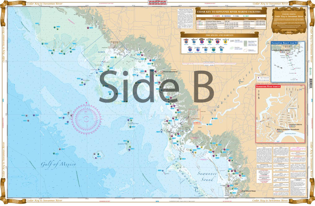
The Area Covered
$32.95
Complete Inshore coverage from the Cross River Barge Canal to Horseshoe Point. We have detailed all the Grass Flats, and include names of all the major creeks. As with all Inshore Fishing Charts, we have preplotted many GPS Coordinates, and species specific areas to find the most popular fish caught in that area. We have listed all the major public boat ramps as well. If you are planning a trip to this area you will want to add this to your list of “Must Haves”.
THIS IS A FOLDED CHART. CAN BE SHIPPED ROLLED UPON REQUEST.
The Area Covered
Complete Inshore coverage from the Cross River Barge Canal to Horseshoe Point. We have detailed all the Grass Flats, and include names of all the major creeks. As with all Inshore Fishing Charts, we have preplotted many GPS Coordinates, and species specific areas to find the most popular fish caught in that area. We have listed all the major public boat ramps as well. If you are planning a trip to this area you will want to add this to your list of "Must Haves". Fishing charts don't come any more in depth than these. We spend countless hours conversing with local charter captains to obtain information to make the perfect fishing chart. There is complete inshore coverage from the Cross River Barge Canal to Horseshoe Point. We have detailed all the grass flats, and include names of all the major creeks. As with all of our inshore fishing charts, we have preplotted many GPS coordinates, and species-specific areas to find the most popular fish caught in that area. Don't worry about finding the fish, we've done all the hard work for you. We have listed all the major public boat ramps as well. If you are planning a trip to this area you will want to add this to your list of "Must Haves". You will want to grab another navigation chart to share with your buddies or have professionally framed to hang on your wall. Nautical chart is 25" X 38". WGS84 - World Mercator Datum.
Additional information
| Dimensions | 24 × 36 in |
|---|