Central California to Cabo San Lucas Maxi Navigation Chart 85
The Area Covered
$32.95
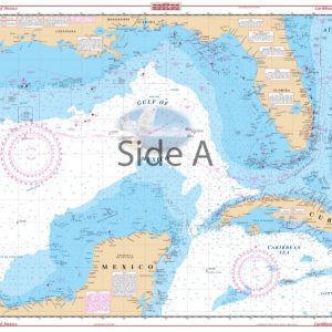
Coverage from Navarro Head California south to Ensenada including Punta Santo Tomas, Punta San Jose, Punta Piedras, and Punta Colnett. GPS waypoint table for the major entrances are listed as well as 10 insets that show the entrances in large scale. Information from 3 NOAA Charts,#18020, #18765, #18640 & NGA #21008. Chart #83 continues north to the Dixon Entrance & Alaska.
The Area Covered
Coverage from Navarro Head California south to Ensenada including Punta Santo Tomas, Punta San Jose, Punta Piedras, and Punta Colnett. GPS waypoint table for the major entrances are listed as well as 10 insets that show the entrances in large scale. Information from 3 NOAA Charts,#18020, #18765, #18640 & NGA #21008. Chart #83 continues north to the Dixon Entrance & Alaska. No trip between Central California and Cabo San Lucas is complete without this marine map. You will be able to easily plot a trip through this region using this highly detailed nautical map. This chart is also excellent for framing and giving as a gift or displaying in a home or office. Coverage from Navarro Head California south to Ensenada including Punta Santo Tomas, Punta San Jose, Punta Piedras, and Punta Colnett. A GPS waypoint table has major entrances listed, as well as 10 insets that show the entrances in large scale. Information from 3 NOAA Charts #18020, #18765, #18640 & NGA #21008. Nautical Chart #83 continues north to the Dixon Entrance and Alaska. Navigation Chart is 25" X 38". WGS84 - World Mercator Datum.
Additional information
| Dimensions | 24 × 36 in |
|---|