Central St. Johns River Fishing Chart 137F
$32.95
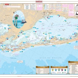
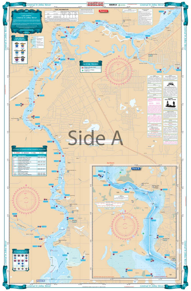
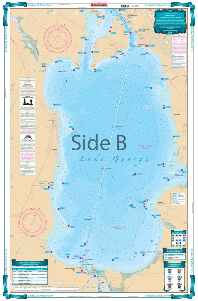
Covering the area from Lake George to Buzzards Island. This chart details all the major grass flats, marshes, and kayak trails. The chart pinpoints dozens of specific areas for the major species caught and best season to catch: Bluegill, Largemouth Bass, Channel Catfish, Bream, and Striped Bass.
THIS IS A FOLDED CHART. CAN BE SHIPPED ROLLED UPON REQUEST.
Covering the area from Lake George to Buzzards Island. This chart details all the major grass flats, marshes, and kayak trails. The chart pinpoints dozens of specific areas for the major species caught and best season to catch: Bluegill, Largemouth Bass, Channel Catfish, Bream, and Striped Bass. There is a handy marine facilities guide included, with locations of different boat ramps, all shown on the chart. You will love looking at this Lake George fishing chart. The artistic illustrations of a bass on one side and colorful fishing scene on the other make this navigation chart great for framing. This marine map covers the area from Lake George to Buzzards Island. This nautical map details all the major grass flats, marshes, and kayak trails. The chart pinpoints dozens of specific areas for the major species caught and best season to catch: Bluegill, Largemouth Bass, Channel Catfish, Bream, and Striped Bass. There is a handy marine facilities guide included, with locations of different boat ramps, all shown on the navigation map to help you find places to dock or get gas. Nautical Chart is 25" X 38". WGS84 - World Mercator Datum.
Additional information
| Dimensions | 24 × 36 in |
|---|