Palm Beach to Fort Pierce Offshore Fish and Dive Chart 127F
The Area Covered
$32.95
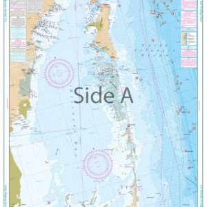
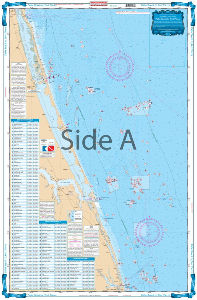
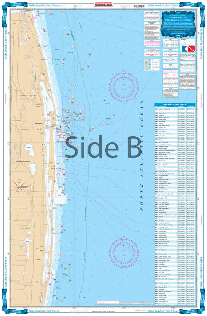
This is the definitive guide to fishing and diving the offshore structures off the coast from Hutchinson Island south to Boynton Inlet. Over 240 fish and dive sites are indexed and plotted with both their local names and their complete GPS coordinates on this comprehensive fishing chart. A new bigger table of coordinates is in large print, making this Palm Beach fishing chart very easy to read.
The Area Covered
The definitive guide to fishing and diving the offshore structure of the coast from Hutchinson Island south to Boynton Inlet. Over 240 fish and dive sites are indexed and plotted with both their local names and their complete GPS coordinates. A new bigger table of coordinates is in large print is very easy to read. Bright colors define shoals, prominent natural fishing areas as well as the "Drop Off".. Local areas "The Loran Tower, The Ranch and the Juno Ball" are clearly marked so that you can understand where the action is. If you are fishing or diving out of Lake Worth Inlet, Jupiter, Stuart or Ft. Pierce this is the one to have. This is the definitive guide to fishing and diving the offshore structures off the coast from Hutchinson Island south to Boynton Inlet. Over 240 fish and dive sites are indexed and plotted with both their local names and their complete GPS coordinates on this comprehensive fishing chart. A new bigger table of coordinates is in large print, making this Palm Beach fishing chart very easy to read. Bright colors define shoals, prominent natural fishing areas, as well as the "Drop Off". Local areas "The Loran Tower, The Ranch and the Juno Ball" are clearly marked so that you can understand where the action is taking place. If you are fishing or diving out of Lake Worth Inlet, Jupiter, Stuart or Ft. Pierce this is the nautical chart to have. Information from 3 government charts: #11460, #11466 and #11474. Navigation Chart is 25" X 38". WGS84 - World Mercator Datum.
Additional information
| Weight | 0.2 oz |
|---|---|
| Dimensions | 24 × 36 in |