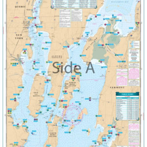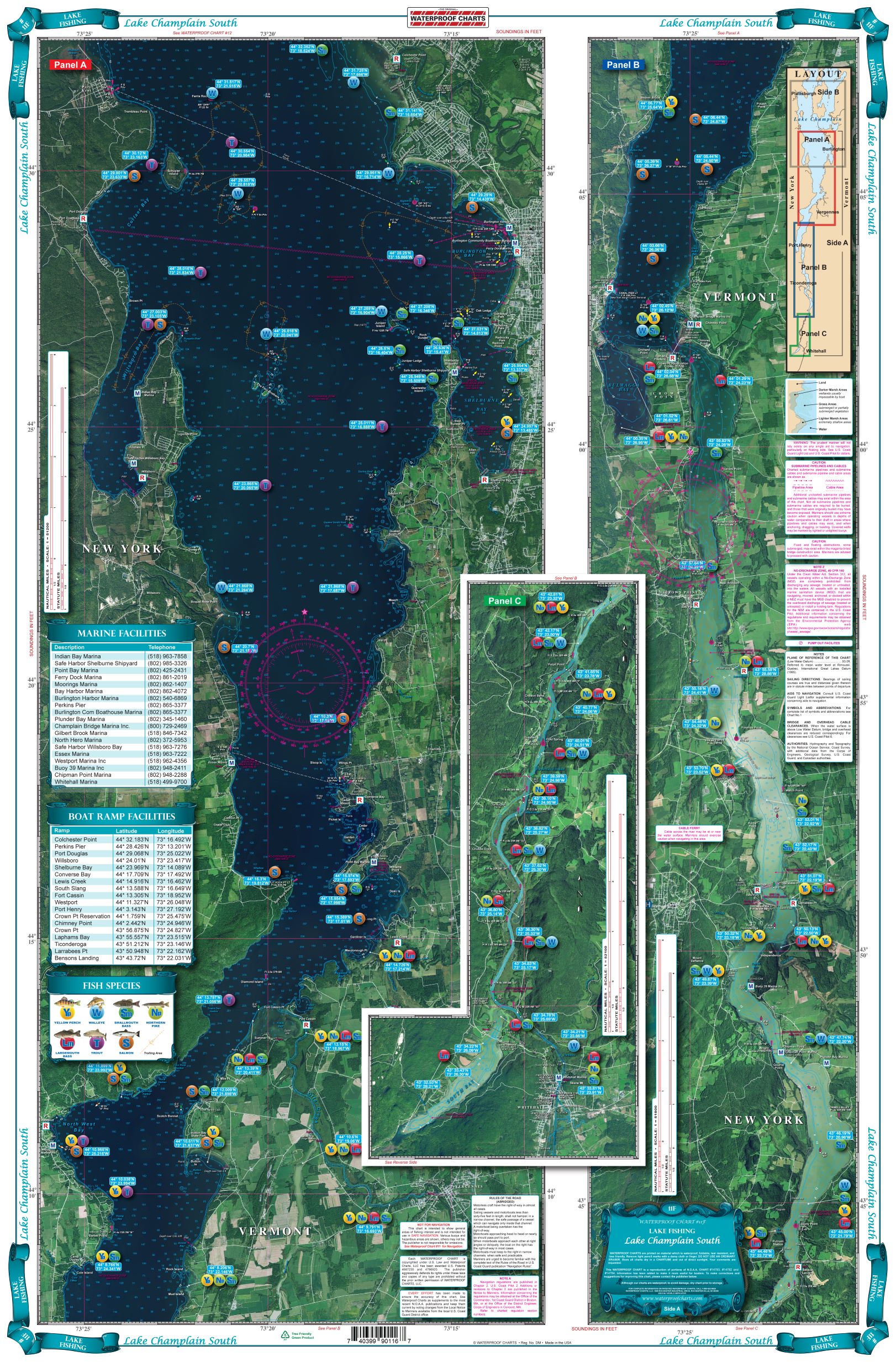
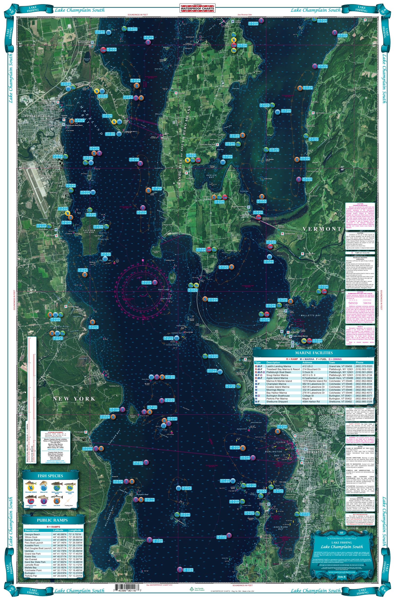
Lake Champlain South Lake Fishing Chart 11F
The Area Covered
$32.95
Are you a fishermen that frequents Lake Champlain? Why don’t you have your Lake Champlain map yet!? This large print Lake Champlain Fishing Chart details all of the major fishing areas and pinpoints dozens of specific areas for the major species caught in the area. Find information on Large and Smallmouth Bass, Yellow Perch, Walleye, Muskie, Northern Pike, Salmon & Trout.
The Area Covered
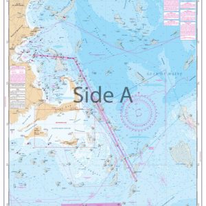
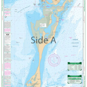
This LARGE PRINT Satellite Lake Chart details all of the Major Fishing Areas and pinpoints dozens of specific areas for the major species caught in the area. (Large and Smallmouth Bass, Yellow Perch, Walleye, Muskie, Northern Pike, Salmon & Trout). Many areas have GPS positions. Grass and Marsh areas are also identified.ÊMarinasÊare listed as well as popular Boat Ramps. From the south, side ÒAÓ starts at Whitehall N.Y. and continues north to Burlington Vt. The reverse side continues north from Willsboro Point and Shelburne Bay to Cumberland Head and Savage Island. Are you a fishermen that frequents Lake Champlain? Why don't you have your Lake Champlain map yet!? This large print Lake Champlain Fishing Chart details all of the major fishing areas and pinpoints dozens of specific areas for the major species caught in the area. Find information on Large and Smallmouth Bass, Yellow Perch, Walleye, Muskie, Northern Pike, Salmon & Trout. Many areas have GPS waypoints of useful locations. Just grab your GPS unit, plug in the coordinates, and you're on your way. Grass and marsh areas are also identified (hint hint these can be some great fishing areas). Marinas are listed on these nautical charts as well as popular boat ramps to help you get in and out of the water. From the south, side “A” starts at Whitehall NY and continues north to Burlington Vt. The reverse side continues north from Willsboro Point and Shelburne Bay to Cumberland Head and Savage Island. If you are addicted to Lake Champlain fishing, you will want to get this navigation chart framed. Information from 3 NOAA Charts; #14782, #14783, #14784. Nautical Chart is 25" X 38". WGS84 - World Mercator Datum.
Additional information
| Dimensions | 24 × 36 in |
|---|