Charleston Harbor to Myrtle Beach Navigation Chart 98
The Area Covered
$32.95
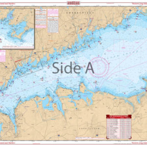
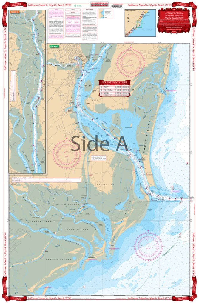
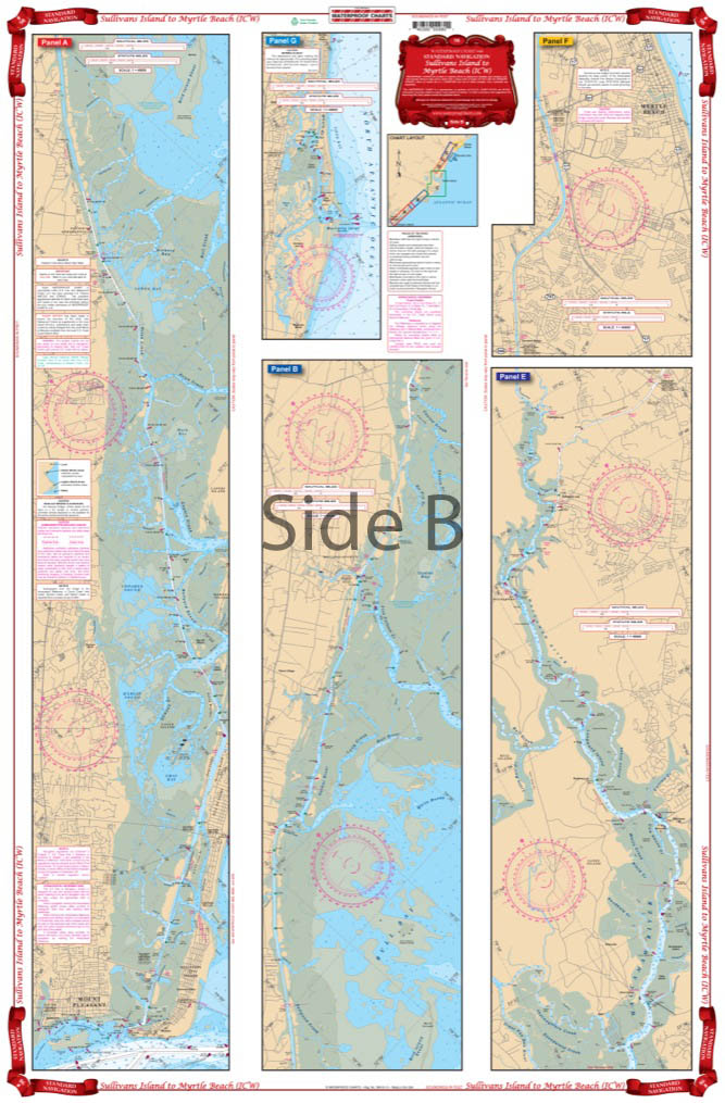
An excellent combination of two government charts makes for easy use. Starting at Sullivans Island, this chart provides complete coverage of the Intracoastal Waterway through Winyah Bay and Georgetown, north to mile maker 365 at Myrtle Beach. Also includes an inset for Murrell’s Inlet. Complete coverage for Winyah Bay and the entrances for the north and south Santee Rivers. This chart provides much more information than the Intracoastal Waterway chart alone!
The Area Covered
An excellent combination of two government charts makes for easy use. Starting at Sullivans Island, this chart provides complete coverage of the Intracoastal Waterway through Winyah Bay and Georgetown, north to mile maker 365 at Myrtle Beach. Also includes an inset for Murrell's Inlet. Complete coverage for Winyah Bay and the entrances for the north and south Santee Rivers. This chart provides much more information than the Intracoastal Waterway chart alone! Take one look at this Myrtle Beach map and you will need no convincing. The vibrant colors and intense amount of detail make this the best navigation chart for the area. An excellent combination of two NOAA charts makes for easy use. Starting at Sullivans Island, this nautical map provides complete coverage of the Intracoastal Waterway through Winyah Bay and Georgetown, north to mile marker 365 at Myrtle Beach. Also includes an inset for Murrell's Inlet. There is complete coverage for Winyah Bay and the entrances for the north and south Santee Rivers. This marine map provides much more information than the Intracoastal Waterway map alone! You will want to frame this chart and hang it in your home or office. Information from NOAA Charts: #11532 & #11518. Nautical Chart is 25" X 38". WGS84 - World Mercator Datum.
Additional information
| Dimensions | 24 × 36 in |
|---|