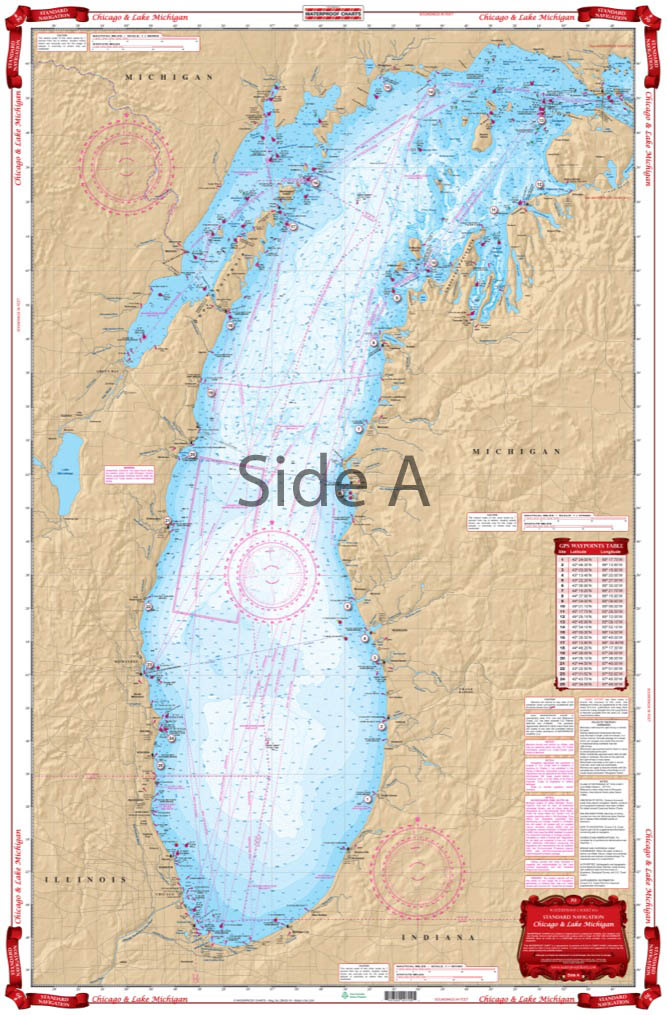
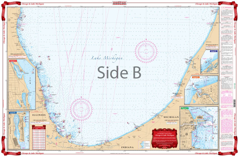
Chicago and Lake Michigan Navigation Chart 70
The Area Covered
$32.95
This combination of charts gives the Chicago area boater all the information one needs. Overall coverage of Lake Michigan on one side with the southern portion of the lake on the reverse side. This combination of 3 NOAA charts gives the Chicago area boater, kayaker, and fisherman all the information one needs.
The Area Covered
This combination of charts gives the Chicago area boater all the information one needs. Overall coverage of Lake Michigan on one side with the southern portion of the lake on the reverse side. This combination of 3 NOAA charts gives the Chicago area boater, kayaker, and fisherman all the information one needs. This Lake Michigan map has all the detail you need whether you are planning a trip or going out on the water for a few hours. Overall coverage of Lake Michigan is on one side with the southern portion of Lake Michigan on the reverse side. If you are an avid boater of Lake Michigan, you will want to frame this navigation chart and hang it in your office or home. NOAA Charts #14901, #14905, & #14926. Nautical Chart is 25" X 38". WGS84 - World Mercator Datum.
Additional information
| Dimensions | 24 × 36 in |
|---|