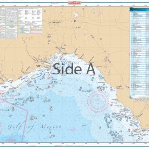
Clearwater to Crystal River Inshore Fishing Chart 31F
The Area Covered
$32.95
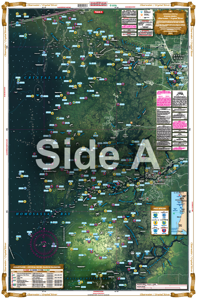
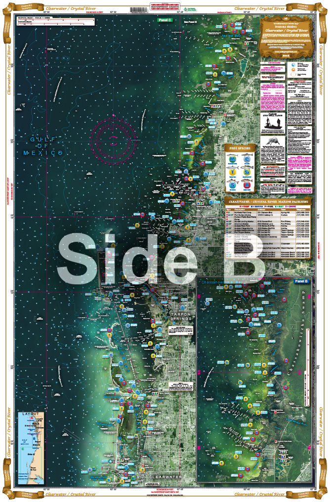
The newest addition to our complete line of Inshore Fishing Charts, this 2 sided, large print, folded chart has complete coverage from Clearwater Pass to Crystal River. This special chart details all of the major grass flats, oyster reefs, and pinpoints dozens of specific areas for the species caught in that area. A handy marine facilities guide gives over 15 boat ramps, as well as information where you can buy bait or fuel. Like all of our Inshore Fishing Charts, this latest one comes inserted in an easy to store folder, with a beautiful artist rendering of a fish caught in area.
THIS IS A FOLDED CHART. CAN BE SHIPPED ROLLED UPON REQUEST.
The Area Covered
The newest addition to our complete line of Inshore Fishing Charts, this 2 sided, large print, folded chart has complete coverage from Clearwater Pass to Crystal River. This special chart details all of the major grass flats, oyster reefs, and pinpoints dozens of specific areas for the species caught in that area. A handy marine facilities guide gives over 15 boat ramps, as well as information where you can buy bait or fuel. Like all of our Inshore Fishing Charts, this latest one comes inserted in an easy to store folder, with a beautiful artist rendering of a fish caught in area. You are going to want to have this in your tackle box or on your desk when planning your next trip to this area. The newest addition to our complete line of Inshore Fishing Charts, this 2 sided, large print, folded chart has complete coverage from Clearwater Pass to Crystal River. This special Clearwater fishing chart details all of the major grass flats, oyster reefs, and pinpoints dozens of specific areas for the species caught in that area. A handy marine facilities guide gives over 15 boat ramps, as well as information where you can buy bait or fuel. Like all of our Inshore Fishing Charts, this latest one comes inserted in an easy to store folder, with a beautiful artist rendering of a fish caught in area. You are going to want to have this in your tackle box or on your desk when planning your next trip to this area. Framed nautical charts also make a great conversation piece for your home or office. Information from NOAA charts: #11411, #11409. Nautical chart is 25" X 38". WGS84 - World Mercator Datum.
Additional information
| Dimensions | 24 × 36 in |
|---|