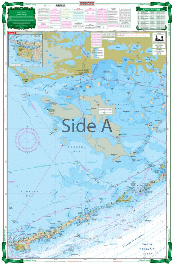
Florida Bay Large Print Navigation Chart 33E
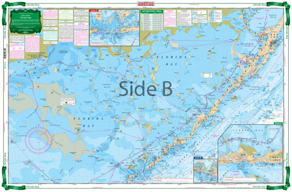
The Area Covered
$32.95
The most detailed and complete coverage of the Everglades National Park area from Key Largo to Flamingo and South to Marathon. This excellent guide to the “Backcountry” details marked cuts and channels, areas of recently reported shoaling, areas open to day use and camping, as well as closed and restricted areas. Contains 39 sets of GPS Waypoints make it easy to set up your electronics. Compass courses from basin to basin and added information on location of water monitoring stations aid both the first time and the experienced explorer.
139 in stock
The Area Covered
The most detailed and complete coverage of the Everglades National Park area from Key Largo to Flamingo and South to Marathon. This excellent guide to the "Backcountry" details marked cuts and channels, areas of recently reported shoaling, areas open to day use and camping, as well as closed and restricted areas. Contains 39 sets of GPS Waypoints make it easy to set up your electronics. Compass courses from basin to basin and added information on location of water monitoring stations aid both the first time and the experienced explorer. The most detailed and complete coverage of the Everglades National Park area from Key Largo to Flamingo and South to Marathon. This excellent guide to the "Backcountry" details marked cuts and channels, areas of recently reported shoaling, areas open to day use and camping, as well as closed and restricted areas. This is the Everglades map for you! Contains 39 sets of GPS Waypoints that make it easy to set up your electronics. Compass courses from basin to basin and added information on location of water monitoring stations aid both the first time and the experienced explorer. If you are an avid baoter in this area, you will want to pick up a second navigation map. One you can keep on your boat, the other you can frame and use to decorate your home or office wall. Information from NOAA charts #11451, #11452 and numerous other sources. Nautical chart is 25" X 38". WGS84 - World Mercator Datum.
Additional information
| Dimensions | 24 × 36 in |
|---|