Fort Walton Beach and Destin ICW Navigation Chart 91
The Area Covered
$32.95
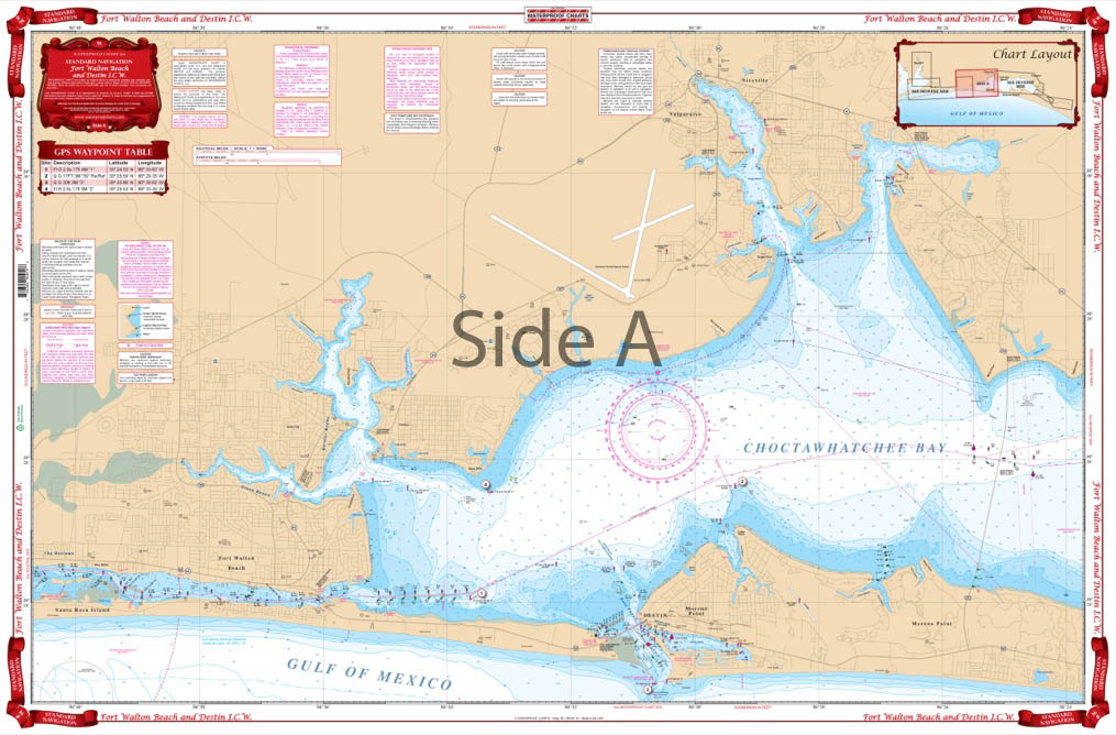
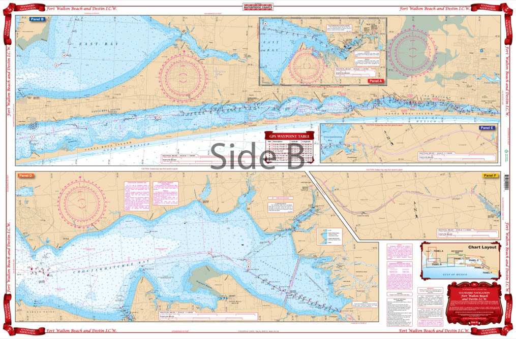
Complete Intracoastal Waterway detail from Oriole Beach at mile marker 195 through mile marker 270 (west of Panama City’s West Bay), and coverage of Choctawhatcee Bay in excellent detail. The Destin, Ft. Walton Beach, and Valparaiso area is enlarged to make it very easy to read. GPS Waypoints are printed directly on the chart. A colored key on each side makes it easy to understand.
The Area Covered
Complete Intracoastal Waterway detail from Oriole Beach at mile marker 195 through mile marker 270 (west of Panama City's West Bay), and coverage of Choctawhatcee Bay in excellent detail. The Destin, Ft. Walton Beach, and Valparaiso area is enlarged to make it very easy to read. GPS Waypoints are printed directly on the chart. A colored key on each side makes it easy to understand. Large Print Place Names make areas easy to find. Don't step foot off that dock without this navigation map in your hands. It has complete Intracoastal Waterway detail from Oriole Beach at mile marker 195 through mile marker 270 (west of Panama City's West Bay), and coverage of Choctawhatchee Bay in excellent detail. The Destin, Ft. Walton Beach, and Valparaiso area is enlarged to make this marine map very easy to read. GPS waypoints are printed directly on the navigation chart. A colored key on each side makes it easy to understand. Large print place names make areas easy to find. This nautical map is full of bright colors making it perfect for framing. Information from NOAA chart #11385. Nautical Chart is 25" X 38". WGS84 - World Mercator Datum.
Additional information
| Dimensions | 24 × 36 in |
|---|