Homosassa Bay to Suwannee River Large Print Navigation Chart 5E
The Area Covered
$32.95
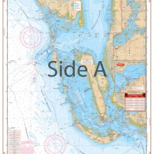
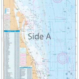
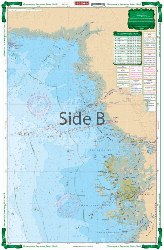
Coastal Coverage from the Chassahowitzka River north through Cedar Key to Suwanee River. Detailed insets of Suwannee and Cedar Key area. Chart splices two NOAA charts for good overview of area. Large Print and improved color scheme make it exceptionally easy to read. Waypoints for GPS users. We have the best nautical charts Florida has to offer. We go in-depth, talking to locals and charter captains, as well as using data from sources like NOAA charts.
The Area Covered
Coastal Coverage from the Chassahowitzka River north through Cedar Key to Suwanee River. Detailed insets of Suwannee and Cedar Key area. Chart splices two NOAA charts for good overview of area. Large Print and improved color scheme make it exceptionally easy to read. Waypoints for GPS users. We have the best nautical charts Florida has to offer. We go in-depth, talking to locals and charter captains, as well as using data from sources like NOAA charts. Coastal coverage runs from the Chassahowitzka River north through Cedar Key to the Suwanee River. Detailed insets of Suwannee and Cedar Key area are also included. This navigation chart splices two NOAA charts for a great overview of area. Large print and improved color scheme make it exceptionally easy to read and perfect for framing. Waypoints for GPS will allow you to easily plug in these coordinates to a GPS unit and get on your way. Information from 2 NOAA charts: #11409 & #11408. Nautical Chart is 25" X 38". WGS84 - World Mercator Datum.
Additional information
| Dimensions | 24 × 36 in |
|---|