Islands of Lake Erie Navigation Chart 68
The Area Covered
$32.95
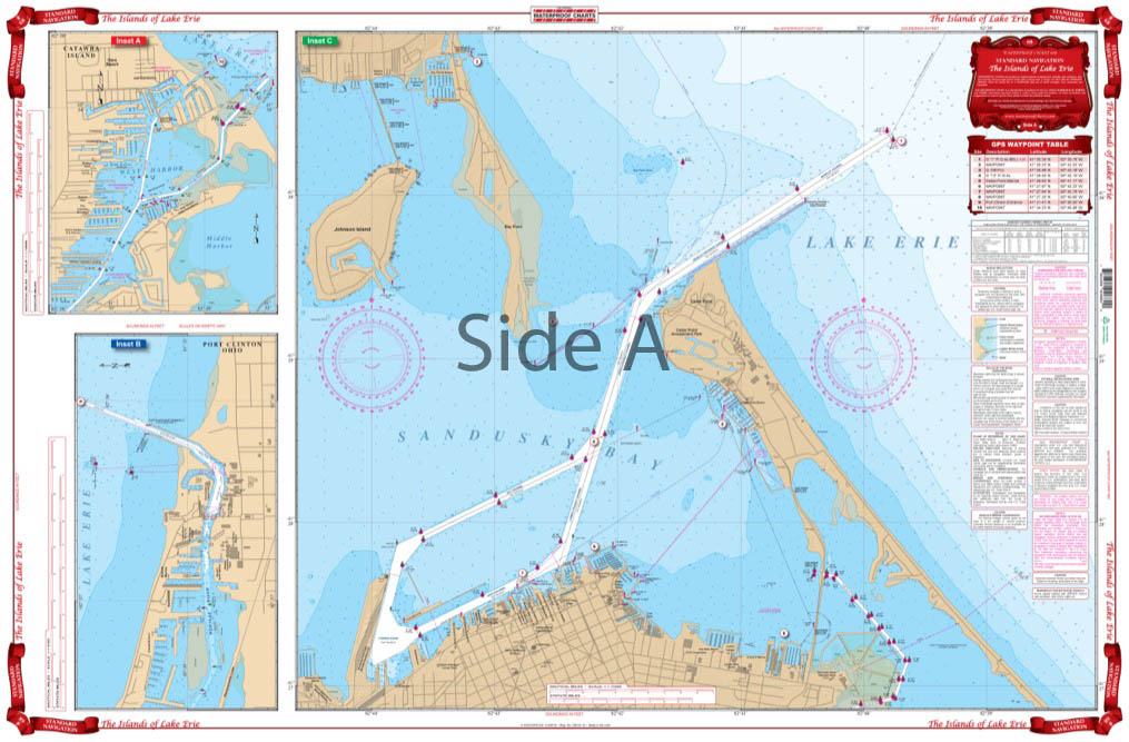
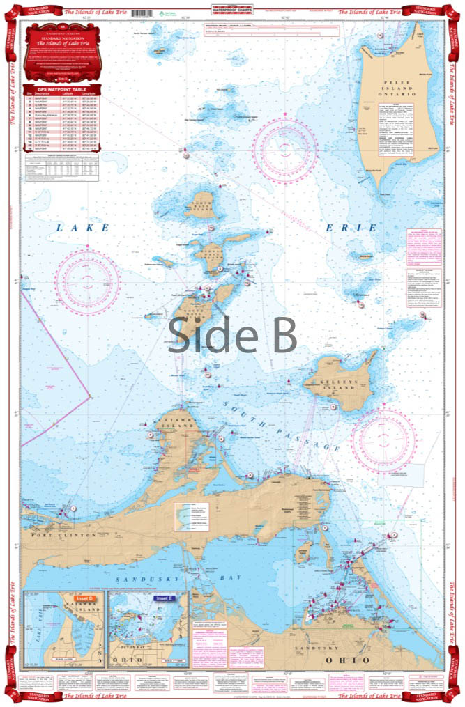
Detailed coverage from Sandusky Bay to Pelee Island with detailed insets for Put-In-Bay and Catawba Cliffs harbor on one side. This chart also has expanded coverage for the Cedar Point and Sandusky waterfront area, as well as details for Port Clinton and Catawaba Island’s west harbor. No competitor has a nautical map of the Lake Erie Islands as detailed as ours’.
The Area Covered
Detailed coverage from Sandusky Bay to Pelee Island with detailed insets for Put-In-Bay and Catawba Cliffs harbor on one side. This chart also has expanded coverage for the Cedar Point and Sandusky waterfront area, as well as details for Port Clinton and Catawaba Island's west harbor. No competitor has a nautical map of the Lake Erie Islands as detailed as ours'. You will enjoy this Lake Erie map so much, you will want us to frame it so you can hang it on your office or home wall. This navigation chart offers detailed coverage from Sandusky Bay to Pelee Island with detailed insets for Put-In-Bay and Catawba Cliffs harbor on one side. This marine map also has expanded coverage for the Cedar Point and Sandusky waterfront area, as well as details for Port Clinton and Catawaba Island's west harbor. Information from 3 NOAA Charts: #14844, #14842, and #14845. Nautical Chart is 25" X 38". WGS84 - World Mercator Datum.
Additional information
| Weight | 0.2 oz |
|---|---|
| Dimensions | 24 × 36 in |