Lake Ponchartrain to Gulfport Navigation Chart 40
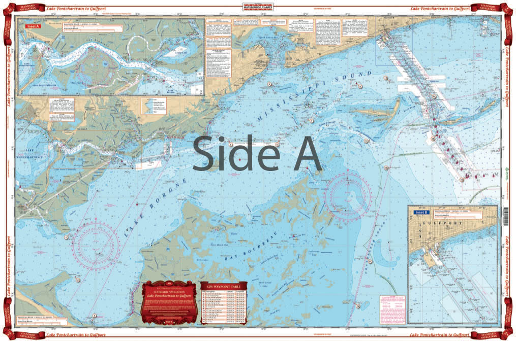
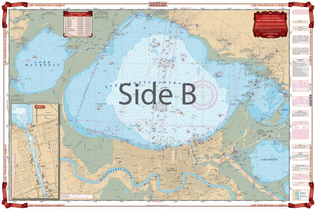
The Area Covered
$32.95
Complete coverage of Lake Ponchartrain and Lake Maurepas, through Chef Menteur Pass and the intracoastal waterway to the Rigolets and Lake Borgne. Includes Mississippi Sound and the Ship Island Area.
The Area Covered
Complete coverage of Lake Ponchartrain and Lake Maurepas, through Chef Menteur Pass and the intracoastal waterway to the Rigolets and Lake Borgne. Includes Mississippi Sound and the Ship Island Area. Details for Gulfport and the Rigolets as well as the Inner Harbor Navigation Canal in New Orleans. This Lake Pontchartrain map is full of bright colors and tons of detail thanks to information from 6 different NOAA charts. This navigation chart has complete coverage of Lake Pontchartrain and Lake Maurepas, through Chef Menteur Pass and the intracoastal waterway to the Rigolets and Lake Borgne. It also includes Mississippi Sound and the Ship Island Area. Details for Gulfport MS and the Rigolets as well as the Inner Harbor Navigation Canal in New Orleans. Contains information from 6 different NOAA Charts: #11369, #11368, #11371, #11372, #11373, and #11367. Nautical Chart is 25" X 38". WGS84 - World Mercator Datum.
Additional information
| Dimensions | 24 × 36 in |
|---|