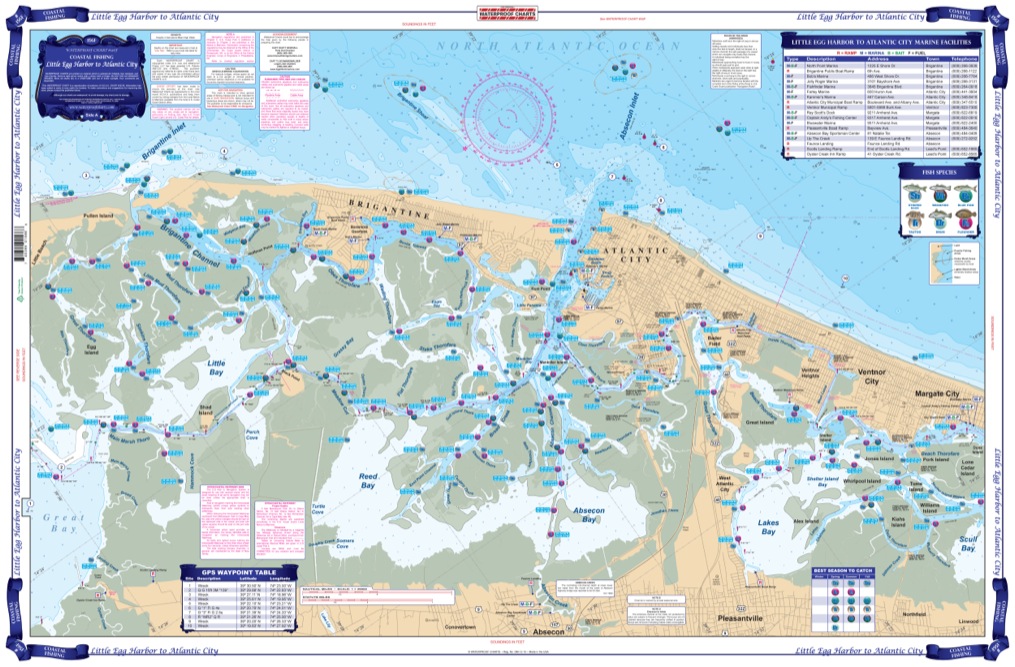
Little Egg Harbor To Atlantic City Coastal Fishing Chart 156F
$32.95
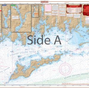
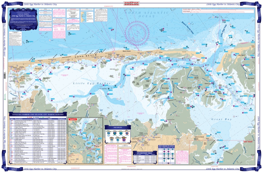
Extremely detailed coverage including the complex inside waterways and rivers from Route 72 bridge southwest to Little Egg Inlet and up the Mullica River. The reverse side continues from Great Bay and Brigantine Inlet to Atlantic City, Ventnor, and Margate City.
Extremely detailed coverage including the complex inside waterways and rivers from Route 72 bridge southwest to Little Egg Inlet and up the Mullica River. The reverse side continues from Great Bay and Brigantine Inlet to Atlantic City, Ventnor, and Margate City. This chart also covers Lakes Bay, Absecon Bay and Reed Bay and Absecon Inlet. With the help of local Fishing Captains, guides, and tackle stores, we have pinpointed the areas most likely to hold fish such as Striped Bass, Blue fish, Weakfish, Croaker, Drum, Tautog, and Flounder. These areas are pinpointed with GPS Coordinates. This chart comes folded and lists many of the popular Boat Ramps and Marinas in the area, and is LARGE PRINT so it's easy to read. If you want to fish Offshore be sure see Waterproof Chart 55F of this area. We've provided the most detail possible for this Little Egg Harbor to Atlantic City fishing chart. There is extremely detailed coverage including the complex inside waterways and rivers from Route 72 bridge southwest to Little Egg Inlet and up the Mullica River. The reverse side continues from Great Bay and Brigantine Inlet to Atlantic City, Ventnor, and Margate City. This navigation chart also covers Lakes Bay, Absecon Bay and Reed Bay and Absecon Inlet. With the help of local Fishing Captains, guides, and tackle stores, we have pinpointed the areas most likely to hold fish such as Striped Bass, Blue fish, Weakfish, Croaker, Drum, Tautog, and Flounder. These areas are pinpointed with GPS Coordinates, making it simple to plug them into your GPS unit and get on your way. This nautical map comes folded and lists many of the popular boat ramps and marinas in the area, and is large print so it's easy to read. Let these vibrant colors out of your boat's glovebox by getting this marine map framed to display on your wall. If you want to fish offshore be sure see Waterproof Chart 55F of this area. Information from NOAA Chart #12316. Nautical Chart is 25" X 38". WGS84 - World Mercator Datum.
Additional information
| Dimensions | 24 × 36 in |
|---|