Lower Florida Keys Navigation Chart 34
The Area Covered
$32.95
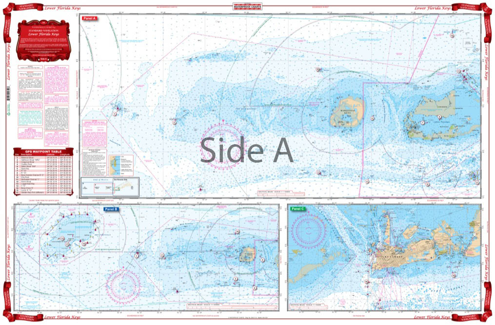
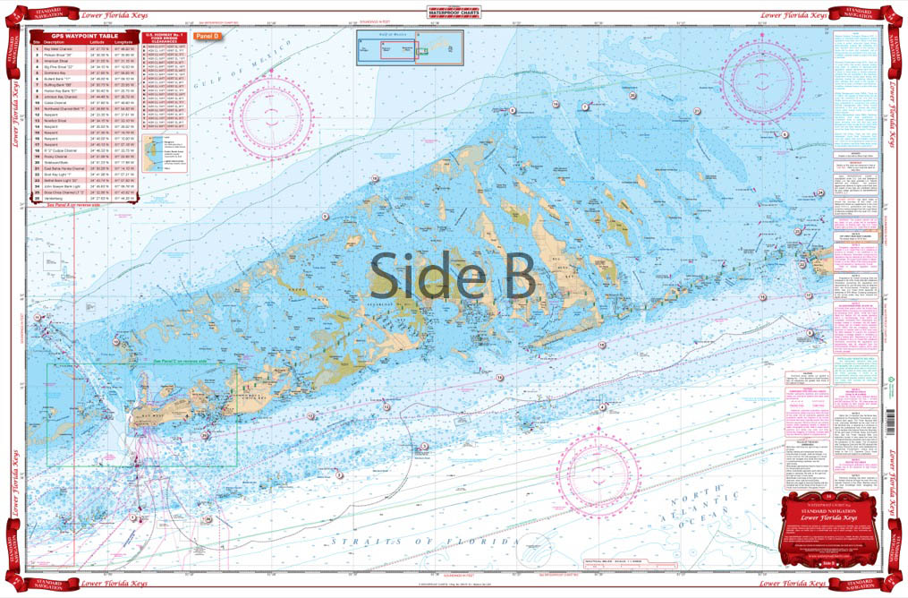
Coverage from Marathon to Key West on one side, the Marquesas and Rebecca Shoal out to the Dry Tortugas on the reverse side. Detailed blow up for Key West Harbor. Also covers the Big Pine area from the reef to the Content Keys and Turtlecrawl Bank. A total of 18 GPS Waypoints are plotted and indexed. Does not give good detail of the Dry Tortugas (see chart #8F). Excellent coverage of Hawk Channel and the Reef.
<…
The Area Covered
Coverage from Marathon to Key West on one side, the Marquesas and Rebecca Shoal out to the Dry Tortugas on the reverse side. Detailed blow up for Key West Harbor. Also covers the Big Pine area from the reef to the Content Keys and Turtlecrawl Bank. A total of 18 GPS Waypoints are plotted and indexed. Does not give good detail of the Dry Tortugas (see chart #8F). Excellent coverage of Hawk Channel and the Reef. This Key West map has it all: vibrant colors, GPS waypoints, detailed coverage. Visitors and experienced boaters, divers, and fishermen alike will get tons of use from this nautical map. You will use this navigation chart so much, you'll want to buy another to frame and hang on your wall. Coverage from Marathon to Key West is on one side, the Marquesas and Rebecca Shoal out to the Dry Tortugas on the reverse side. We've also included a detailed blow up for Key West Harbor. This marine chart also covers the Big Pine area from the reef to the Content Keys and Turtlecrawl Bank. A total of 18 GPS Waypoints are plotted and indexed to help you find interesting spots in the area. Excellent coverage of Hawk Channel and the Reef. For details of the Dry Tortugas see navigation chart #8F. Information from 4 NOAA Charts: #11442, #11439, #11434, & #11445. Nautical chart is 25" X 38". WGS84 - World Mercator Datum.
Additional information
| Dimensions | 24 × 36 in |
|---|