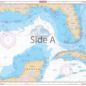


Lower St. John’s River Navigation Chart 37S – DISCONTINUED
The Area Covered
No valid coordinates found for this map.
$32.95
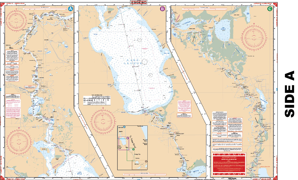
Starting at Palatka, coverage is upstream thru Lake George and Astor, thru Lake Dexter, to Lake Monroe and the city of Sanford, Lake Jesup and Lake Harney. Features 13 marked fuel stations.
Out of stock
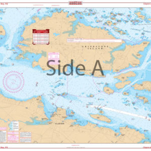
The Area Covered
No valid coordinates found for this map.
Starting at Palatka, coverage is upstream thru Lake George and Astor, thru Lake Dexter, to Lake Monroe and the city of Sanford, Lake Jesup and Lake Harney. Features 13 marked fuel stations. The St Johns River map is going to make your time on the water much easier. You will feel confident heading out on the water using this navigation chart. This highly detailed navigation map starts at Palatka, coverage is upstream thru Lake George and Astor, thru Lake Dexter, to Lake Monroe and the city of Sanford, Lake Jesup and Lake Harney. This marine map features 13 marked fuel stations to ensure your tanks are always full. The vibrant colors make this nautical map easy to comprehend and perfect for framing. Information from 2 NOAA charts; #11495 & #11492. Nautical Chart is 25" X 38". WGS84 - World Mercator Datum.
Additional information
| Dimensions | 24 × 36 in |
|---|