Naples Inshore Fishing Chart 4F
$32.95
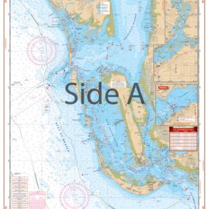
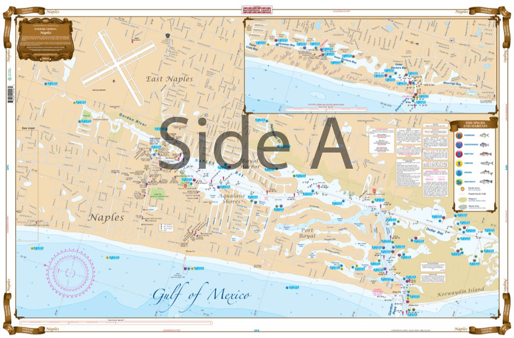
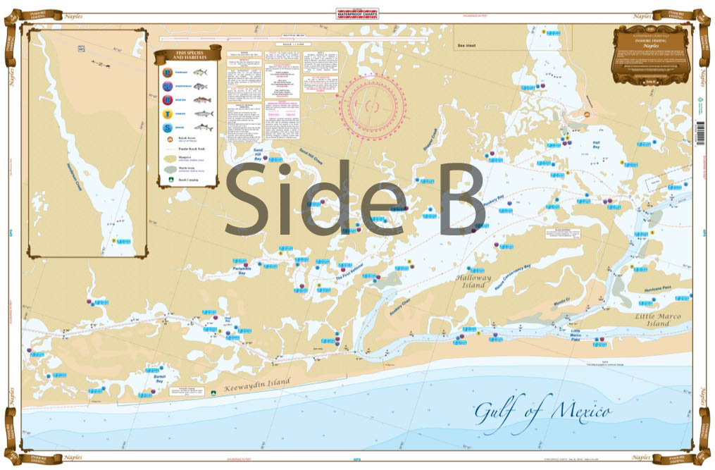
This chart has complete coverage from Outer Clam Bay including Doctors Pass, Gordon Pass, all of Naples Bay,and the Gordon River South to Dollar Bay on side A.. On the reverse side coverage is from Keewaydin Island including Bartell Bay, The First National, Rookery Bay, Henderson Creek, Halloway Island to little Marco Island.
THIS IS A FOLDED CHART. CAN BE SHIPPED ROLLED UPON REQUEST.
This chart has complete coverage from Outer Clam Bay including Doctors Pass, Gordon Pass, all of Naples Bay,and the Gordon River South to Dollar Bay on side A.. On the reverse side coverage is from Keewaydin Island including Bartell Bay, The First National, Rookery Bay, Henderson Creek, Halloway Island to little Marco Island. This special chart pinpoints dozens of specific areas for the major species caught in this area, such as Trout, Redfish, Pompano, Snook,Tarpon, and Sheepshead. All pinpointed with GPS Coordinates. Waterfront points of interest include Marinas, Boat Ramps, Kayak Launches, Kayak Trails, Parks, Roads, Restaurants,and more. If you are thinking of fishing this area you will need to add this to the list of must have charts. This chart is LARGE PRINT and very easy to use. This Naples fishing chart has complete coverage from Outer Clam Bay including Doctors Pass, Gordon Pass, all of Naples Bay, and the Gordon River South to Dollar Bay on side A. On the reverse side coverage is from Keewaydin Island including Bartell Bay, The First National, Rookery Bay, Henderson Creek, Halloway Island to little Marco Island. This special navigation chart pinpoints dozens of specific areas for the major species caught in this area, such as Trout, Redfish, Pompano, Snook, Tarpon, and Sheepshead. All locations are pinpointed with GPS coordinates. Waterfront points of interest include marinas, boat ramps, kayak launches, kayak trails, parks, roads, restaurants,and more. If you are thinking of fishing in Naples FL you will need this marine map in your tackle box. This navigation map is large print and very easy to use. The colors and detail make it excellent for framing. Information from NOAA Chart #11430. Nautical Chart is 25" X 38". WGS84 - World Mercator Datum.
Additional information
| Dimensions | 24 × 36 in |
|---|