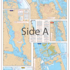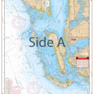
Naples to Marco Island Large Print Navigation Chart 41E
The Area Covered
$32.95
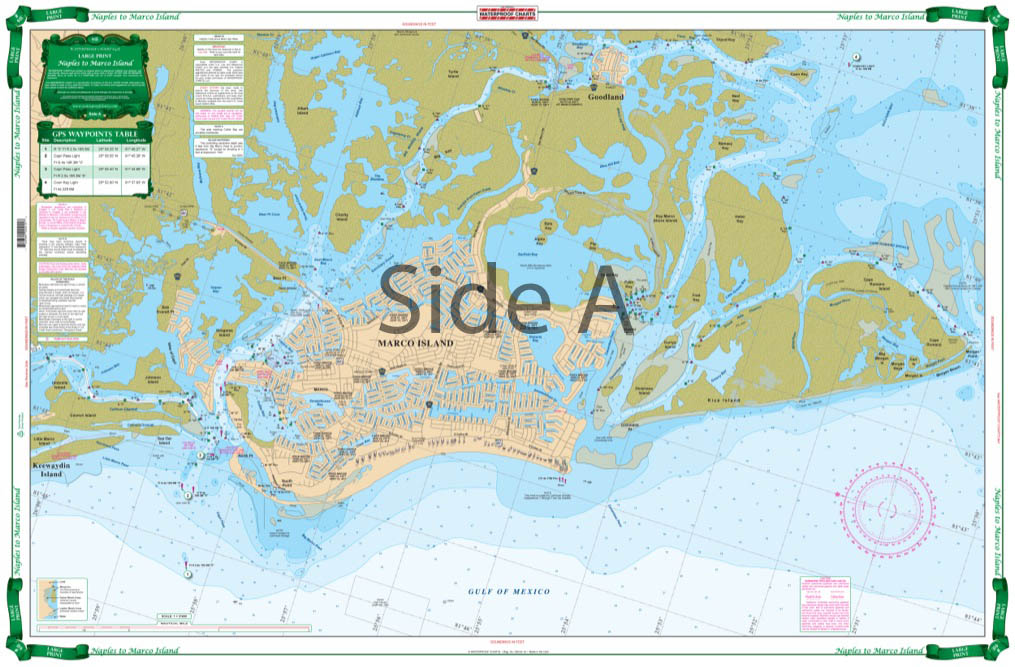
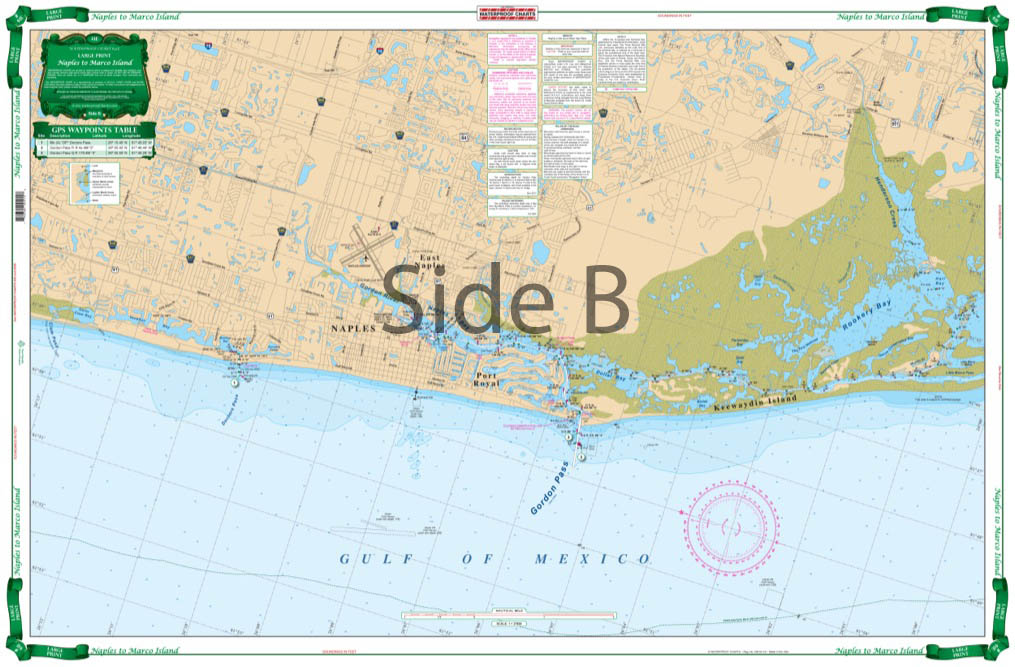
A great blow up of the popular area from Doctor’s Pass south past Gordon Pass to Marco and Goodland. Includes detail of the Gordon River and Naples Bay, Capri Pass, Big Marco River, and Coon Key Pass, plus the inner Cape Romano Shoals. Very big type is easy to read, big place names make areas easy to find. Waypoints on both sides. Coastal coverage to 2 miles offshore. Southwest Florida boaters, kayakers, and other water adventureres need this nautical map on their vessel.
The Area Covered
A great blow up of the popular area from Doctor's Pass south past Gordon Pass to Marco and Goodland. Includes detail of the Gordon River and Naples Bay, Capri Pass, Big Marco River, and Coon Key Pass, plus the inner Cape Romano Shoals. Very big type is easy to read, big place names make areas easy to find. Waypoints on both sides. Coastal coverage to 2 miles offshore. Southwest Florida boaters, kayakers, and other water adventureres need this nautical map on their vessel. This navigation map includes a great blow up of the popular area from Doctor's Pass south past Gordon Pass to Marco and Goodland. It also includes detail of the Gordon River and Naples Bay, Capri Pass, Big Marco River, and Coon Key Pass, plus the inner Cape Romano Shoals. Very large type makes this navigation chart easy to read, and sizeable place names make areas easy to find. GPS waypoints are included on both sides. Coastal coverage runs up to 2 miles offshore. And don't stop there! This nautical chart shouldn't just be kept on the boat. Once you see the vibrant colors and immense detail you will want to frame it and hang it in your home or office. Information from NOAA Chart #11430. Nautical Chart is 25" X 38". WGS84 - World Mercator Datum.
Additional information
| Dimensions | 24 × 36 in |
|---|