New Jersey Coastal Fishing Chart 55F
The Area Covered
$32.95
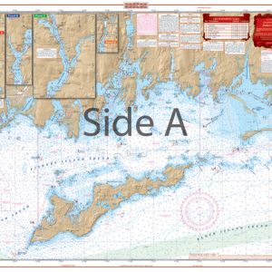
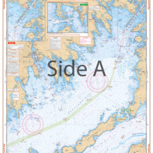
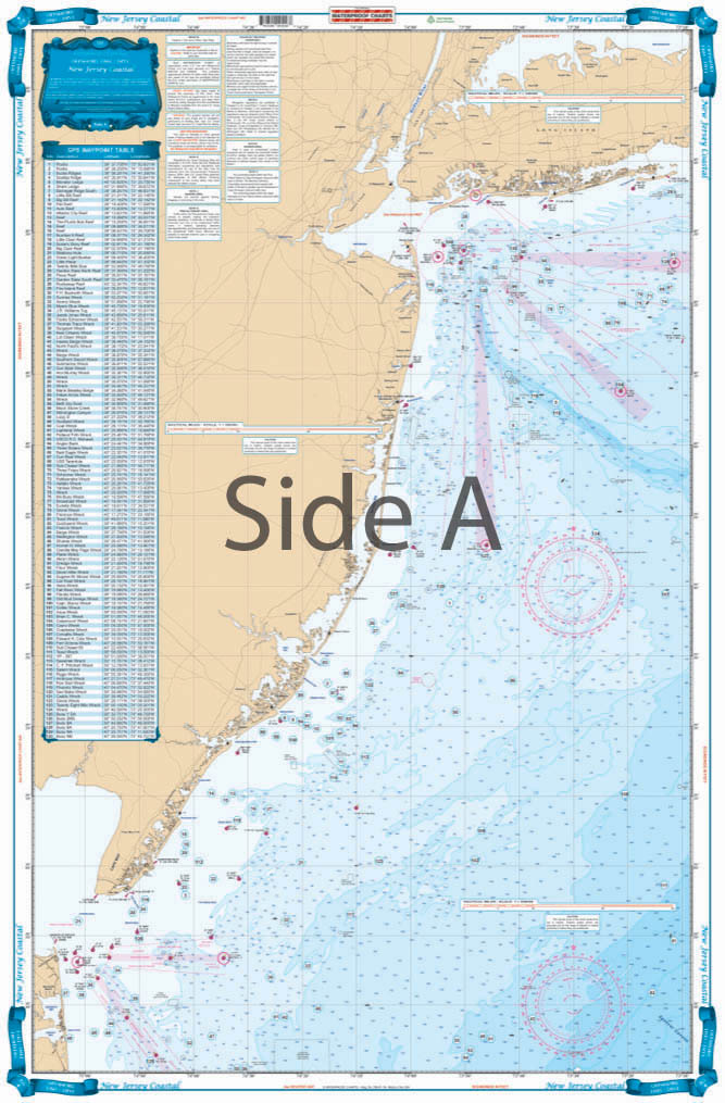
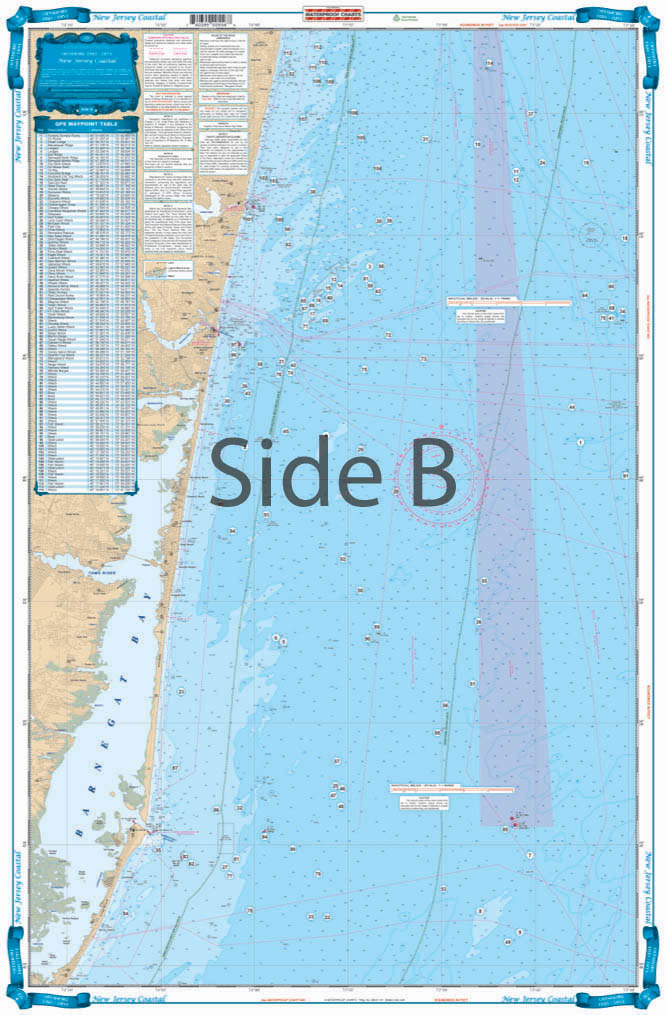
The best chart for fishing or diving off of New Jersey. Side A covers all of Coastal New Jersey from Long Island south to 20 miles south of Cape May. 4 different colors are used to describe water depths. Coverage is offshore to 73 degrees 10 Minutes West Longitude. Side B covers the area from Long Branch south to Barnegat Inlet in better detail (does not cover Barnegat Bay or other insidewaters – for detail inside see chart #56). A total of 244 PLOTTED GPS POSITIONS are given for reefs and wrecks, fish havens, rocks, lights, and buoys. Each waypoint is individually plotted so you can see its position relative to other sites, and inlets.
The Area Covered
The best chart for fishing or diving off of New Jersey. Side A covers all of Coastal New Jersey from Long Island south to 20 miles south of Cape May. 4 different colors are used to describe water depths. Coverage is offshore to 73 degrees 10 Minutes West Longitude. Side B covers the area from Long Branch south to Barnegat Inlet in better detail (does not cover Barnegat Bay or other insidewaters - for detail inside see chart #56). A total of 244 PLOTTED GPS POSITIONS are given for reefs and wrecks, fish havens, rocks, lights, and buoys. Each waypoint is individually plotted so you can see its position relative to other sites, and inlets. Bright colors and large print make this chart extremely easy to use and read. This is the best navigation chart for NJ fishing or diving, hands down. Side A covers all of Coastal New Jersey from Long Island south to 20 miles south of Cape May. We have used 4 different colors are to describe water depths. Coverage runs offshore to 73 degrees 10 minutes west longitude. Side B covers the area from Long Branch south to Barnegat Inlet in better detail (For detail of Barnegat Bay and inside waters see nautical chart #56). A total of 244 plotted GPS positions are given for reefs and wrecks, fish havens, rocks, lights, and buoys. Each waypoint is individually plotted so you can see its position relative to other sites, and inlets. Bright colors and large print make this navigation map extremely easy to use and read. Information from 4 different NOAA Charts; #12326, #12323, #12200 & #12300. Nautical Chart is 25" X 38". WGS84 - World Mercator Datum.
Additional information
| Dimensions | 24 × 36 in |
|---|