Long Island Sound New Rochelle to Norwalk Large Print Navigation Chart 26E
The Area Covered
$32.95
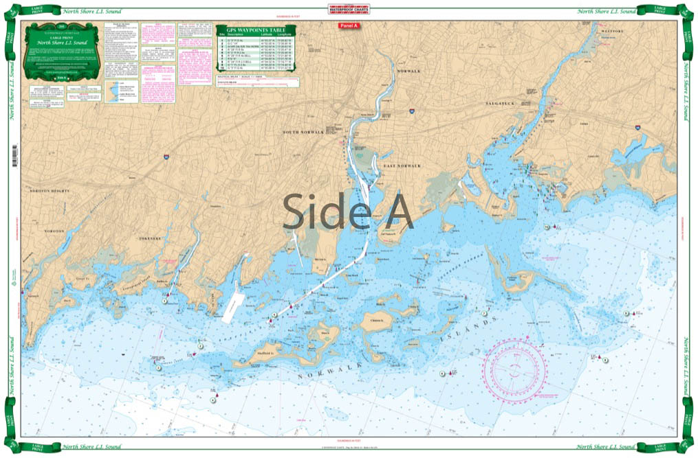
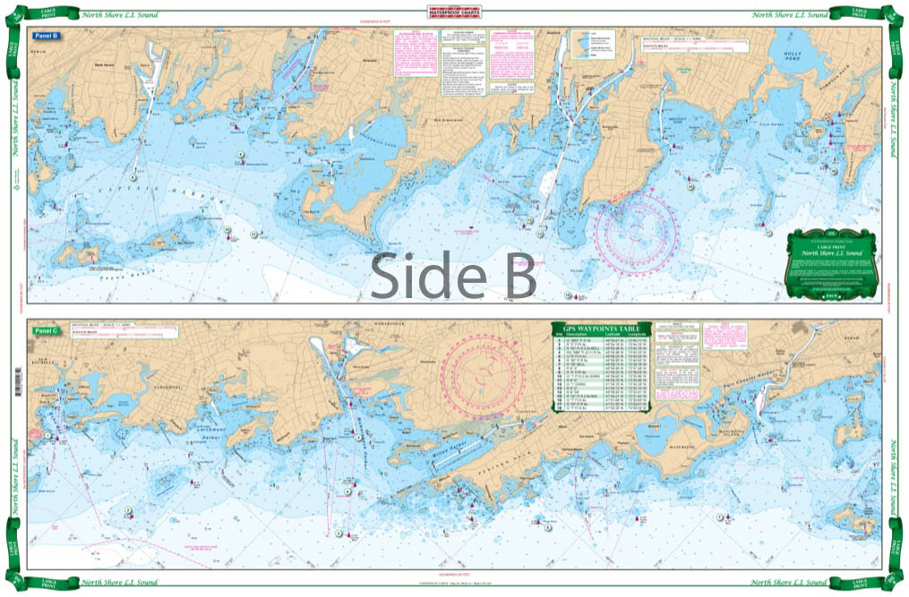
Excellent detailed coverage of the coastal islands and harbors, from New Rochelle and Mamaroneck, east through Greenwich, Stamford, and Norwalk. Includes the Norwalk Islands. GPS Waypoints make it easy to set up your GPS unit.
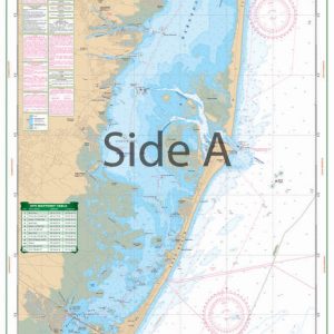
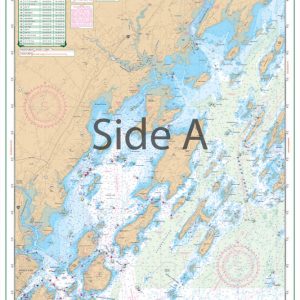
The Area Covered
Excellent detailed coverage of the coastal islands and harbors, from New Rochelle and Mamaroneck, east through Greenwich, Stamford, and Norwalk. Includes the Norwalk Islands. GPS Waypoints make it easy to set up your GPS unit. This Long Island Sound map creates a sense of awe and wonder, even in the most experience of boaters. The amount of detail is extraordinary! Excellent detail includes coverage of the coastal islands and harbors, from New Rochelle and Mamaroneck, east through Greenwich, Stamford, and Norwalk. This nautical map also includes the Norwalk Islands. GPS Waypoints make it easy to set up your GPS unit and get on your way. The vibrant colors of thie navigation chart make it excellent for framing. A combination of 2 NOAA Charts: #12368 and #12367. Nautical chart is 25" X 38". WGS84 - World Mercator Datum.
Additional information
| Weight | 0.2 oz |
|---|---|
| Dimensions | 24 × 36 in |