North Lake Huron and Straits of Mackinac Navigation Chart 75
The Area Covered
$32.95
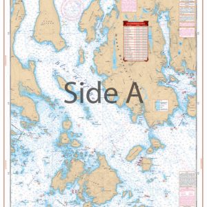
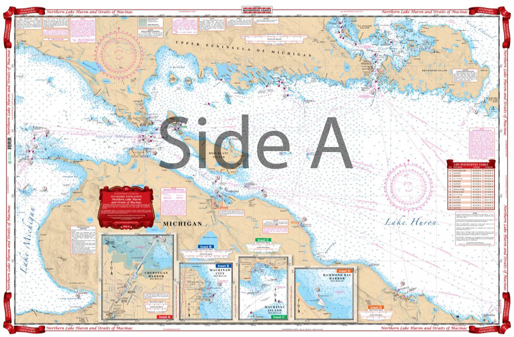
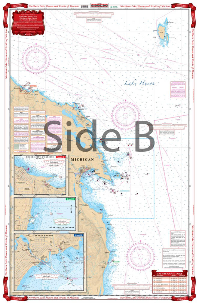
Coverage from Harrisville, Michigan, north to Great Duck Island and west to Rogers City on the south side with detailed harbor blow ups for Alpena Harbor, Harrisville Harbor, and Rogers City and Calcite, Michigan. The north side covers from Presque Isle Harbor, Michigan, north to Drummond and St. Joseph Islands, and west past the Straits of Makinac and Makinac Island to the Grays Reef Passage in Lake Michigan. Harbor details for Hammond Bay Harbor, Mackinaw City, Mackinac Island and Cheboygan Harbor.
The Area Covered
Coverage from Harrisville, Michigan, north to Great Duck Island and west to Rogers City on the south side with detailed harbor blow ups for Alpena Harbor, Harrisville Harbor, and Rogers City and Calcite, Michigan. The north side covers from Presque Isle Harbor, Michigan, north to Drummond and St. Joseph Islands, and west past the Straits of Makinac and Makinac Island to the Grays Reef Passage in Lake Michigan. Harbor details for Hammond Bay Harbor, Mackinaw City, Mackinac Island and Cheboygan Harbor. This Lake Huron map offers pristine coverage of the northern edge of the Lake. You will look forward to unfolding this navigation chart and plotting your next journey. Coverage runs from Harrisville, Michigan, north to Great Duck Island and west to Rogers City on the south side with detailed harbor blow ups for Alpena Harbor, Harrisville Harbor, and Rogers City and Calcite, Michigan. The north side covers from Presque Isle Harbor, Michigan, north to Drummond and St. Joseph Islands, and west past the Straits of Mackinac and Mackinac Island to the Grays Reef Passage in Lake Michigan. Harbor details for Hammond Bay Harbor, Mackinaw City, Mackinac Island and Cheboygan Harbor are included. Grab two of these navigation charts. One you will place on your vessel, the other we will frame so you can hang it in your home or office. Information from 3 NOAA Charts: #14880, #14881 & #14864. Nautical Chart is 25" X 38". WGS84 - World Mercator Datum.
Additional information
| Dimensions | 24 × 36 in |
|---|